
Aharbal Waterfall: Veshaw River, Gorge and Mountain Landscape
The Veshaw River’s waterfall, rocky gorge and wider relationship with Kashmir’s mountain drainage.
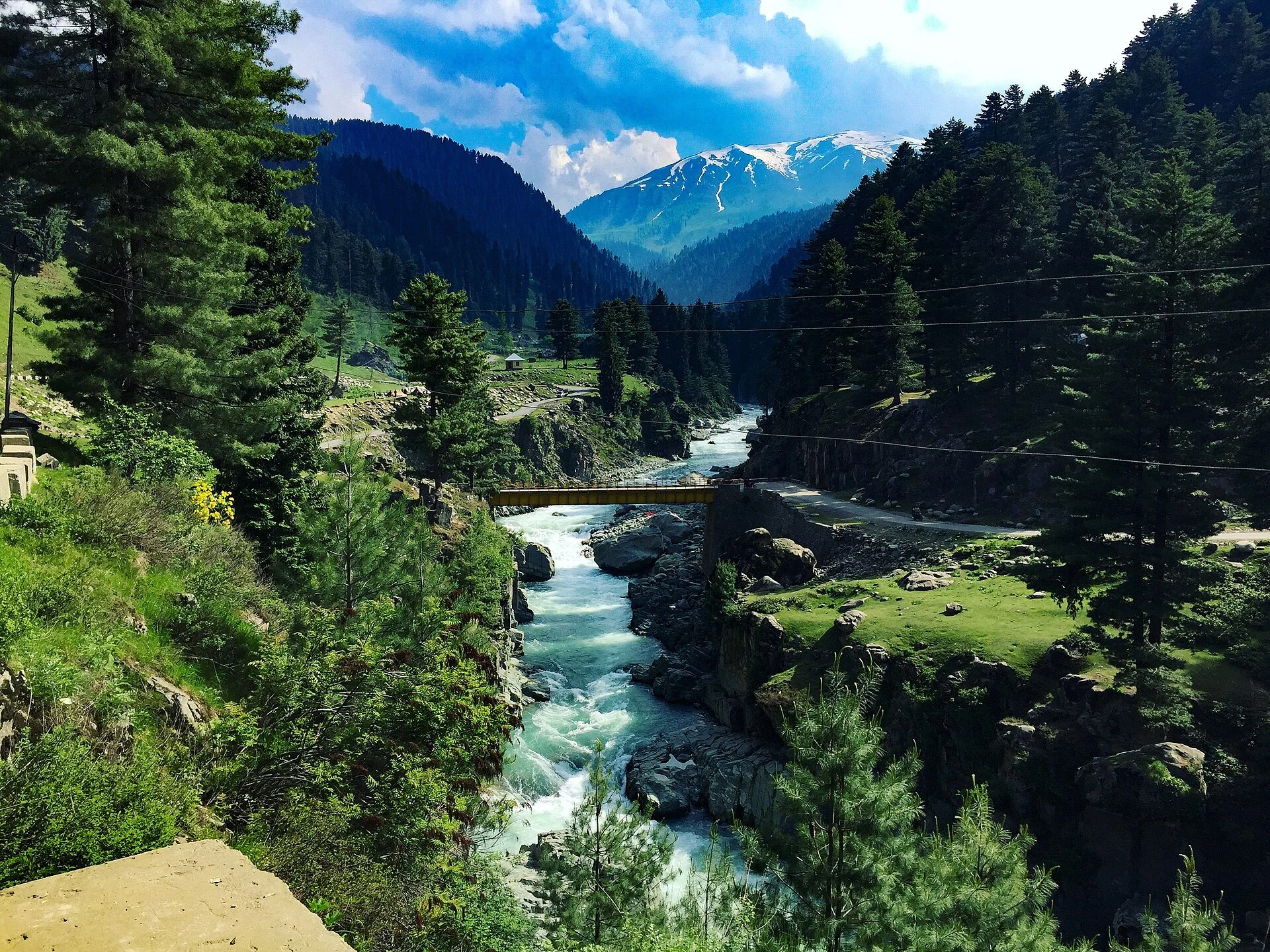
Aharbal Waterfall is a major fall on the Veshaw River in Kulgam district, in the south-western Kashmir Valley. Veshaw, Vishav and Veshu are spellings encountered in descriptions of the river. The district administration places the waterfall at the centre of Aharbal’s landscape, where flowing water, a steep drop and a confined gorge create a feature very different from the valley’s broad lakes. Its familiar nickname, “Niagara of Kashmir”, is a comparison used in tourism writing rather than a scientific classification.[1]
A river descending through rock
The secondary geographical account describes the Veshaw as a tributary of the Jhelum and places Aharbal in the Pir Panjal landscape. It records a drop of roughly 25 metres followed by a smaller descent through a narrow rocky gorge. A waterfall is consequently not just the line where water falls: the approaching channel, rock walls and pool below form one connected landform. The river continues beyond the photographed scene, linking the mountain landscape with the wider valley drainage.[2]
The Airports Authority of India’s regional tourism description places Aharbal at about 2,266 metres above sea level and associates it with pine-covered mountain terrain. This elevation refers to the locality, not a measurement of the waterfall’s vertical drop. Keeping those two figures separate helps explain the setting without confusing the height of a mountain settlement with the dimensions of a river feature.[3]
The landscape around the fall
The Kulgam profile connects Aharbal with nearby trekking and fishing interests. These associations broaden the geographical picture, but do not establish that every trail or water activity is currently available. The waterfall is the main subject of this article; routes farther into the mountains and individual fishing areas require their own descriptions and permissions. A river viewed from a designated overlook is also a different environment from the water’s edge below a gorge.[1]
The secondary account identifies terraces and paths near the falls. Their presence shows how visitor access has been organised around a difficult landform. A railing or path does not change the physical character of a steep, wet gorge. For practical orientation, the important distinction is between a place from which the feature can be observed and a route attempting to reach the flow itself.[2]
Reading a waterfall photograph
The accompanying image records Aharbal’s water and rocky setting at a particular moment. The shape of the channel is more enduring than the precise volume of water visible in a photograph. A single image should therefore be read as evidence of a dated view, rather than as a measurement of year-round discharge. The fall’s sound, movement and enclosed setting also explain why still photographs capture only part of its character.
Aharbal adds a mountain-river perspective to this encyclopedia’s existing water entries. The Jhelum in Srinagar shows a river within an urban setting, while Wular Lake introduces a broad receiving wetland. Verinag Spring offers another way to examine the relationship between flowing water and a named place. These connections follow geography rather than promise a particular travel itinerary.
Photograph and map record
Photograph: Dar.burhan via Wikimedia Commons. Licence: CC BY-SA 4.0. Recorded capture date: 2017-05-27 15:56:09. Resized and converted to WebP; scene content unchanged. This is a dated view, not confirmation of the site’s present appearance.

Map marker: 33.64596, 74.780686. Representative coordinate from the secondary geographical reference; not a surveyed boundary or a verified accessible entrance. View location on OpenStreetMap · View Google Maps · Google directions · OpenStreetMap directions.
Research checked: 14 October 2026. For a visit, confirm current access, transport and opening information with the relevant authorities. This encyclopedia profile provides geographical and historical context.
Sources & references
[1] Primary place or institutional account
https://kulgam.nic.in/tourist-place/aharbal/ ↗
[2] Secondary historical and geographical reference
https://en.wikipedia.org/wiki/Aharbal ↗
[3] AAI — Regional tourism geography
https://aai.aero/en/airports/city-info/srinagar/Tourist-Place ↗
Photograph and licence