
Jhelum River in Srinagar: Vyath, Crossings and Riverfront Heritage
The urban Jhelum, its place in regional drainage, bridges and connections with Srinagar’s built heritage.
Vyath and the shape of Srinagar
The Jhelum River, known locally as Vyath, is one of the principal geographical features of Srinagar. Settlement extends along both banks, and bridges connect parts of the city. The district administration identifies the river and its crossings as characteristic elements of Srinagar’s landscape. It is useful to study the urban river as a sequence of banks, bridges and neighbourhoods rather than as a single viewpoint. [1]
This article concerns the river in Srinagar, not every part of its larger course. The same river name appears in descriptions of the Kashmir Valley and the wider Indus basin. A local riverfront account and a basin-scale account answer different questions: one concerns the city’s relationship with water, the other its place in regional drainage.
A larger drainage system
The Central Water Commission’s Indus Basin Organisation places the Jhelum within the Indus drainage system. Its description follows the river through the Kashmir Valley and discusses the reach between Khanabal and Srinagar. The river’s urban passage should therefore be read as part of a larger movement of water through the valley, rather than as a water body beginning or ending inside the city. [2]
A bridge coordinate only identifies a point along that passage. It does not define the river’s source, length or catchment. For the map in this entry, Zero Bridge provides a named representative crossing with published coordinates. Readers seeking a basin boundary need a different type of map from the point marker used here. [3]
Crossings and Zero Bridge
Zero Bridge is described in the referenced secondary account as a timber pedestrian crossing connecting the Sonwar and Rajbagh sides of the Jhelum. The account records its origins in the 1950s, later restrictions on vehicle use and restoration work. Its history illustrates how a crossing can change function while remaining a recognisable part of the city. [3]
The history of one crossing should not be used to date all Srinagar bridges. Nor should “old bridges” be interpreted as a promise that every present structure retains its original materials. Urban crossings are repaired, rebuilt and adapted. When investigating an individual bridge, distinguish the first crossing at a site from the fabric visible today.
Riverfront heritage
Sher Garhi Palace is one example of built heritage associated with the riverbank. The Srinagar Heritage account locates it on the Jhelum’s left bank and connects its history with an eighteenth-century Afghan governor. This relationship between water and a historic compound adds another layer to the city’s riverfront, alongside the story of its crossings. [4]
A useful reading of the riverfront considers more than isolated monuments. Views between banks, the position of a crossing and the relationship of buildings to the edge of the water can all help explain how different places fit together. This is an interpretive approach to the landscape, not a claim that every visible building is protected heritage.
A dated view of the river
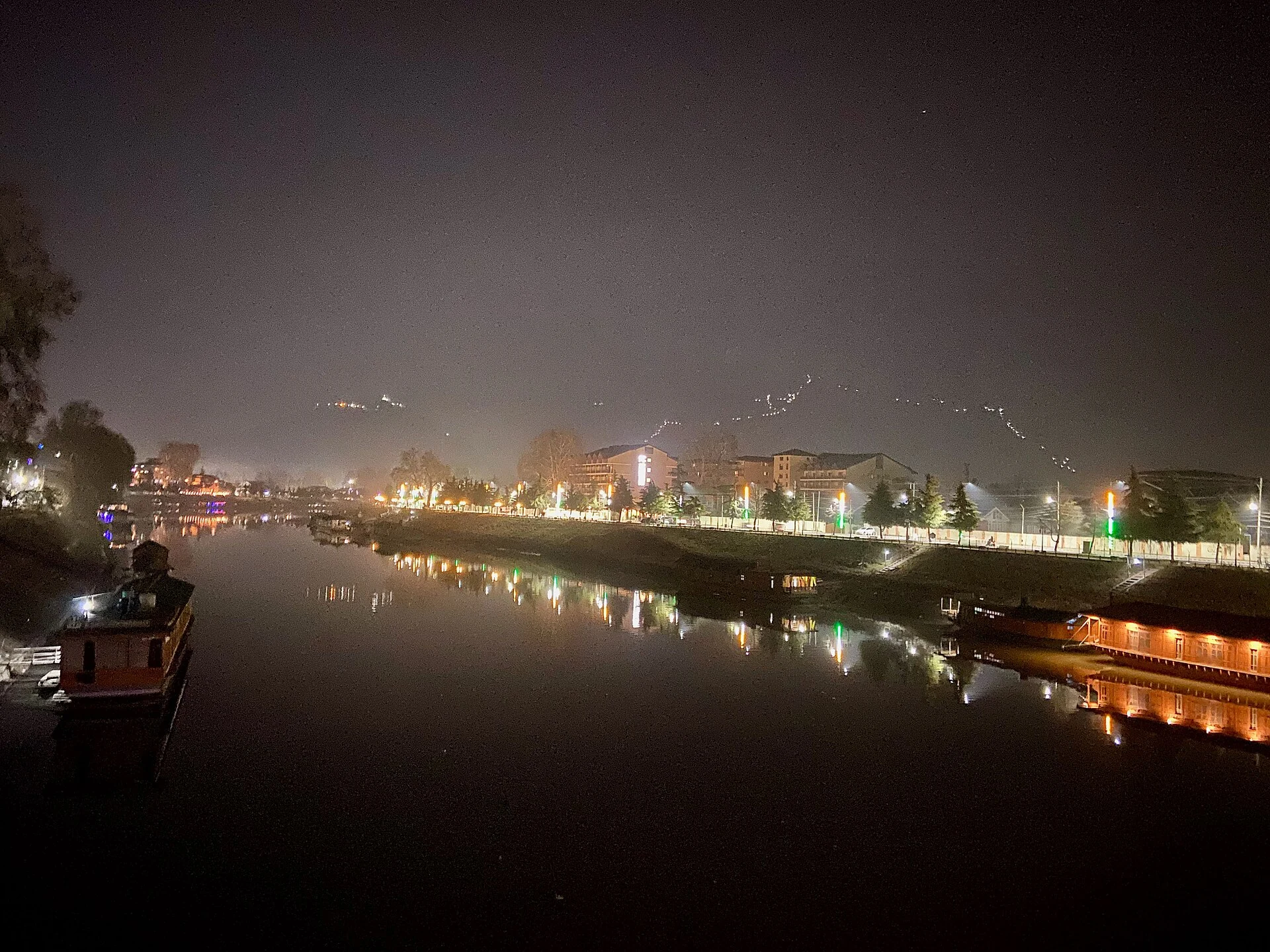
The included photograph identifies a Srinagar view of the Jhelum in its source metadata. It offers one perspective on water and the adjoining cityscape; its caption preserves the creator and recorded date. Photography can document changes in a riverfront over time, but a single image cannot measure discharge, establish flood risk or demonstrate that a walkway is open. [5]
![[5]](https://commons.wikimedia.org/wiki/File:Jhelum_River_at_night,_Srinagar.jpg)
Exploring responsibly
Use designated paths and crossings, and follow local restrictions around the water. Confirm the accessibility of a particular walking route before setting out, especially after adverse weather. For operational river or flood information, consult the responsible current authority rather than interpreting this historical overview as an advisory.
Read the district overview alongside this entry, and compare the river landscape with Dal Lake. Jamia Masjid introduces a different part of Srinagar’s architectural and civic history.
Photograph credit and map
Photograph: Niranjan Ramamurthy, via Wikimedia Commons, CC BY-SA 4.0. Resized and converted to WebP; no scene elements altered. Recorded date: 2025-01-23 19:30:49.
Map marker: Zero Bridge point from secondary reference; represents one crossing, not the whole river.
For regional airport, railway and bus connections, consult the district transport guide.
Research date: 13 October 2026. Confirm changing access arrangements before travelling.
Sources & references
[1] District Srinagar — Geography
https://srinagar.nic.in/demography/ ↗
[2] Central Water Commission — Indus basin details
https://cwc.gov.in/ibo/about-basins ↗
[3] Zero Bridge — secondary historical/geographical reference
https://en.wikipedia.org/wiki/Zero_Bridge ↗
[4] Srinagar Heritage — Sher Garhi Palace
https://srinagarheritage.in/p/sher-garhi-palace ↗
[5] Photograph source and licence
https://commons.wikimedia.org/wiki/File:Jhelum_River_at_night,_Srinagar.jpg ↗
[6] District Srinagar — regional transport guide
Related reading
Chashma Shahi: The Royal Spring and Its Mughal Garden
The spring-centred design, Mughal commission, traditions and setting of Chashma Shahi.
Dachigam National Park: Landscape, Hangul and Conservation
Dachigam’s protection history, varied terrain, water connections and wildlife-conservation context.
Dal Lake: Waterways, Floating Gardens and Life on the Lake
An introduction to Dal Lake’s connected basins, working waterscape, floating gardens, boats and cultural setting.