
Wular Lake: Flood Storage, Wetland Ecology and Livelihoods
Wular as a connected Jhelum wetland, a working landscape and a conservation priority spanning Bandipora and Baramulla.
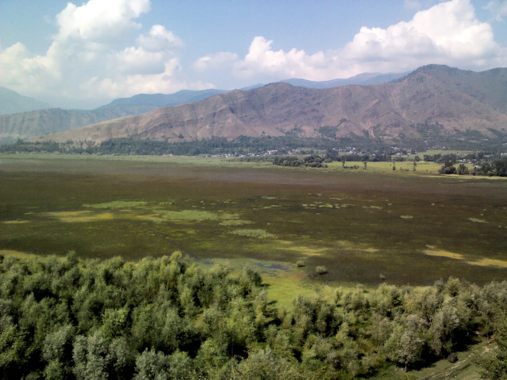
Wular Lake is a major freshwater wetland in the Kashmir Valley, connected with the Jhelum River. The Wular Conservation and Management Authority’s account places the lake across Bandipora and Baramulla districts. This encyclopedia assigns the article to Bandipora as its primary district filter, while retaining the cross-district relationship in the text. The filter is an editorial filing choice, not a claim that the entire waterbody falls within one district.[1]
A changing water landscape
Wular is widely described as one of the region’s largest freshwater lakes. Its reported surface area varies with season, water level and the definition used for open water or associated marshes. The secondary geographical reference records a wide seasonal range. For that reason, a single undated area figure or a simple ranking can conceal more than it explains. The lake should be understood as a changing water-and-wetland system.[2]
The Baramulla district description places Wular between the Sopore and Bandipora sides of the valley and identifies the Jhelum as its principal water source. The district’s published measurements and ranking are retained here as background reading rather than repeated as timeless statistics. Looking at the lake through neighbouring settlements gives a useful human scale to an otherwise very large geographical feature.[4]
Flood storage and livelihoods
Wetlands International describes Wular as important for regulating water movement in the Kashmir Valley. Its lake and marsh habitats support migratory waterbirds, fisheries and livelihoods linked with water chestnuts, fodder and other wetland resources. The same organisation records its Ramsar designation in 1990. These relationships make conservation a question of both ecological function and household livelihoods, rather than landscape appearance alone.[3]
The organisation’s 2016 case study connects reclamation, drainage and plantations with the loss of water spread and marsh habitat. Reduced storage capacity affects communities around the lake and farther downstream. Its proposed restoration measures included reconnecting marshes, addressing silt and improving catchment management. This is a dated account of a management approach, not a measurement of the lake’s condition today.[3]
Conservation administration
The Wular Conservation and Management Authority was established in September 2012. The official account describes work on boundaries, catchment conservation, biodiversity, livelihoods and public awareness. It identifies siltation, pollution and invasive growth among the challenges. These multiple responsibilities explain why restoration cannot be assessed solely by a photograph of open water or a newly landscaped shoreline.[1]
Reading the connected system
The relationship between Wular and the Jhelum in Srinagar helps connect upstream urban river geography with a large receiving wetland. Dal Lake and Nigeen Lake introduce other Kashmir waterscapes. These comparisons reveal different combinations of settlement, working water, habitat and recreation; they do not imply identical hydrology or management needs.
Photograph and map record
Photograph: Mehrajmir13 via Wikimedia Commons. Licence: CC BY-SA 3.0. Recorded capture date: 2012-08-20. Resized and converted to WebP; scene content unchanged. This is a dated view, not confirmation of the site’s present appearance.

Map marker: 34.369556, 74.5592611. Representative point from the cited secondary geographical reference; not a surveyed boundary, entrance or access recommendation. View location on OpenStreetMap.
Research checked: 13 October 2026. For a visit, confirm current access, transport and opening information with the relevant authorities. This encyclopedia profile provides geographical and historical context.
Sources & references
[1] District Bandipora — Wular Conservation and Management Authority
https://bandipore.nic.in/wucma/ ↗
[2] Wular Lake — secondary geographical reference
https://en.wikipedia.org/wiki/Wular_Lake ↗
[3] Wetlands International — Wular restoration case study
[4] District Baramulla — Wular Lake
https://baramulla.nic.in/tourist-place/wular-lake/ ↗
Photograph and licence