
Gulmarg: Meadow, Resort History and Winter Sports
A connected profile of Gulmarg’s upland meadow, historical patronage, recreational landscape and winter sports.
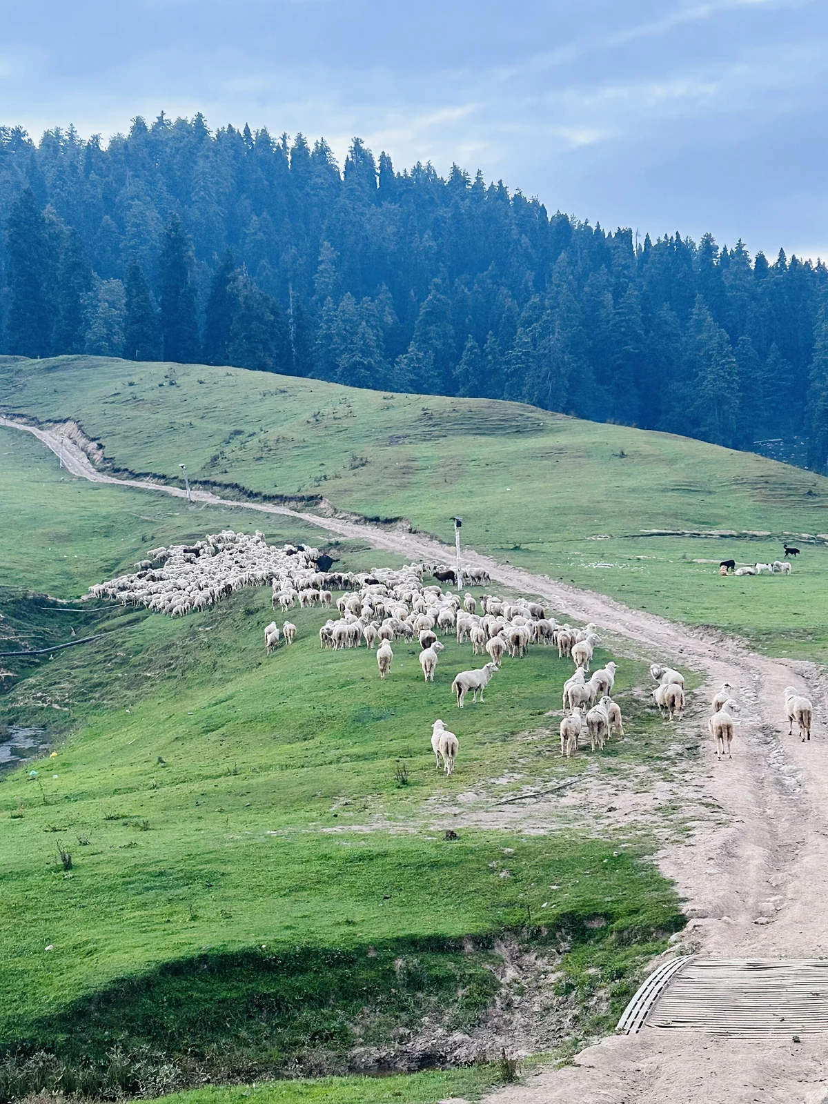
Gulmarg is an upland town and resort in Baramulla district, in Kashmir. Its name is generally interpreted as “meadow of flowers”. The meadow, surrounding woodland and higher mountain slopes form the basis of its identity, but Gulmarg is also a settlement with a documented history of royal visits, recreation and organised winter sport. Its geography and its resort history are best read together.[2]
Setting and seasonal character
Gulmarg lies in the Pir Panjal mountain range at an elevation commonly given as approximately 2,650 metres. The secondary geographical profile places it within the Gulmarg Wildlife Sanctuary landscape. This setting helps distinguish the town’s meadow from the much higher terrain reached beyond it. A photograph of green grass in one season does not describe the snow cover, access or conditions of the same location in another season.[2]
The Ministry of Tourism describes summer meadows and forest walks alongside winter skiing and other snow recreation. The golf course, Khilanmarg, the gondola and the Apharwat landscape represent different parts of this recreational geography. They should not be combined into a single undifferentiated attraction: the meadow, a neighbouring valley and higher mountain terrain each deserve their own location description and article.[3]
Historical patronage
The Baramulla district account connects Gulmarg with Yousuf Shah Chak and Mughal emperor Jahangir. It also records the earlier name Gaurimarg and the renaming associated with Yousuf Shah Chak. Later, Gulmarg became a summer retreat for British residents in India. The explorer Aurel Stein is among the historical visitors mentioned by the administration. These successive associations show how the same landscape acquired different recreational meanings over time.[1]
Sport and the resort landscape
The secondary history records a ski club established in 1927 and the subsequent development of winter-sport facilities. The gondola connects the resort with higher ground near Apharwat. Read together, these details suggest a progression from seasonal retreat towards a destination supported by specialised recreation infrastructure. The dates and routes of particular facilities should remain separate from claims about the age of the settlement itself.[2]
The tourism profile also identifies the Maharani Temple and the Baba Reshi shrine within the wider visitor landscape. Their inclusion adds religious heritage to the geographical picture; they are living devotional places as well as landmarks. Describing their association with Gulmarg does not mean that both stand in the centre of the meadow.[3]
Access and connected reading
The district guide identifies Srinagar Airport, the Baramulla railhead and road connections from Srinagar and Baramulla. Its distances are route estimates from an older page, rather than fixed measurements for every starting point.[1]
The USBRL project and Katra–Srinagar train inauguration in June 2025 changed regional rail connectivity. Check present services rather than relying on older destination guides.[4]
Compare Sonamarg and Pahalgam for other upland settlements. Dal Lake introduces Srinagar’s contrasting waterside landscape.
Photograph and map record
Photograph: Harvinder Chandigarh via Wikimedia Commons. Licence: CC BY 4.0. Recorded capture date: 2024-09-19 18:38:18. Resized and converted to WebP; scene content unchanged. This is a dated view, not confirmation of the site’s present appearance.

Map marker: 34.05815, 74.391556. Photograph geotag; representative view location, not a town boundary or approved arrival point. View location on OpenStreetMap.
Research checked: 13 October 2026. For a visit, confirm current access, transport and opening information with the relevant authorities. This encyclopedia profile provides geographical and historical context.
Sources & references
[1] District Baramulla — Gulmarg
https://baramulla.nic.in/tourist-place/gulmarg/ ↗
[2] Gulmarg — secondary geographical and historical reference
https://en.wikipedia.org/wiki/Gulmarg ↗
[3] Ministry of Tourism — Gulmarg
https://www.incredibleindia.gov.in/en/jammu-and-kashmir/gulmarg ↗
[4] Prime Minister’s Office — June 2025 rail connectivity
Photograph and licence
https://commons.wikimedia.org/wiki/File:Landscape_view_of_Gulmarg,_Kashmir_01.jpg ↗
Related reading
Pahalgam: Lidder Valley, Settlement and Pilgrimage Connections
Pahalgam’s river setting, name, neighbouring valleys and role in the Amarnath pilgrimage landscape.
Sonamarg: Sind Valley Landscape and Mountain Connections
Sonamarg’s meadow landscape, Sind Valley setting, mountain connections and changing access infrastructure.