
Sonamarg: Sind Valley Landscape and Mountain Connections
Sonamarg’s meadow landscape, Sind Valley setting, mountain connections and changing access infrastructure.
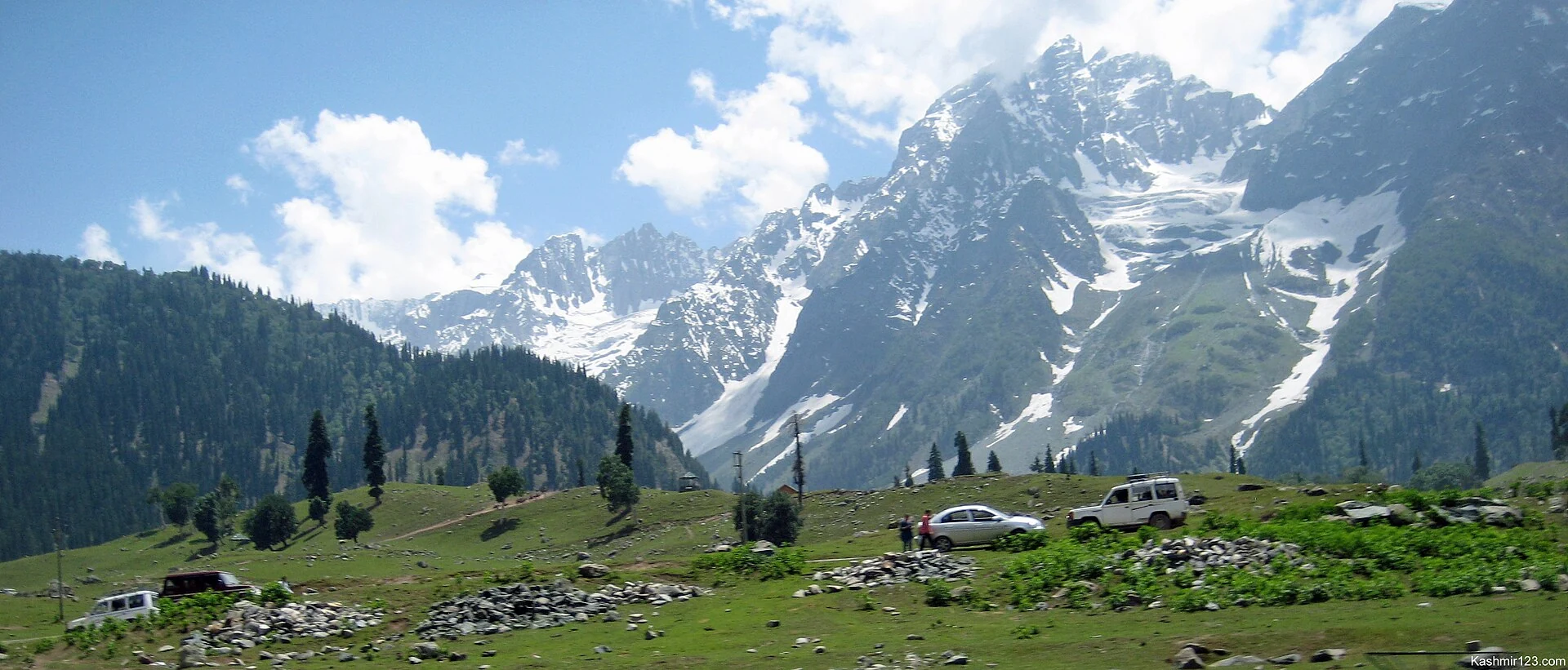
Sonamarg is a mountain settlement and resort in Ganderbal district, in the Kashmir region of Jammu and Kashmir. The name is commonly translated as “meadow of gold”; Sonmarg and the Kashmiri form Sonamarag also appear in geographical references. Its identity combines open summer meadows, a high valley setting and a position on the route from the Kashmir Valley towards Ladakh. These features explain why it belongs in both a geographical encyclopedia and a history of regional travel.[2]
The valley and its landscape
The district administration describes Sonamarg through the Sind Valley and the mountains surrounding its meadows. The Sind River is central to this landscape. Thajiwas, nearby Baltal and the approach towards Zoji La connect the settlement with a much wider mountain environment. A view from the roadside represents only one part of that environment: the inhabited corridor, the grazing landscape and higher snow-covered terrain should be understood as related but distinct places.[1]
Sonamarg’s elevation is approximately 2,730 metres in the secondary geographical reference used here. Summer meadow vegetation and the river setting contrast with the snow conditions of colder months. Its historical significance is also connected with routes between Kashmir and the Tibetan world. These geographical relationships help explain the settlement’s role as a stopping point and gateway, rather than treating it simply as an isolated scenic destination.[2]
Mountain connections
The official district profile associates Sonamarg with trekking routes towards several high-altitude lakes, including Vishansar, Krishansar, Gangabal and Gadsar. Baltal is separately described as a base associated with the Amarnath pilgrimage. Listing these places together does not make them interchangeable destinations: a mountain lake, a pilgrimage base and a roadside settlement have different terrain and purposes. Their individual entries should retain those distinctions.[1]
Changing access infrastructure
The Sonamarg Tunnel was inaugurated in January 2025. The Prime Minister’s Office described winter connectivity to Sonamarg as one of the project’s purposes. This changes how older descriptions of seasonal isolation should be read. The tunnel is an infrastructure connection to Sonamarg; it should not be interpreted as confirmation that every road beyond the settlement, or every higher trekking route, remains open throughout the year.[3]
The Kashmir Valley’s rail connection also changed with the dedication of the USBRL project and the flagging off of Katra–Srinagar Vande Bharat trains in June 2025. Older “nearest railhead” statements require fresh checking.[4]
Connected reading
For comparison, read Gulmarg for a different upland resort landscape and Pahalgam for another river-valley settlement. The Kargil district profile follows the regional connection towards Ladakh. These links support geographical comparison; they are not a suggested itinerary or a statement of current road availability.
Photograph and map record
Photograph: Kashmir Pictures via Wikimedia Commons. Licence: CC BY 2.0. Recorded capture date: 2013-05-05 04:27. Resized and converted to WebP; scene content unchanged. This is a dated view, not confirmation of the site’s present appearance.
.jpg)
Map marker: 34.30146, 75.29252. Representative point from the cited secondary geographical reference; not a surveyed boundary, entrance or access recommendation. View location on OpenStreetMap.
Research checked: 13 October 2026. For a visit, confirm current access, transport and opening information with the relevant authorities. This encyclopedia profile provides geographical and historical context.
Sources & references
[1] District Ganderbal — Sonamarg
https://ganderbal.nic.in/tourist-place/sonamarg/ ↗
[2] Sonamarg — secondary geography and coordinates
https://en.wikipedia.org/wiki/Sonamarg ↗
[3] Prime Minister’s Office — Sonamarg Tunnel inauguration
https://www.pmindia.gov.in/en/news_updates/pm-inaugurates-sonamarg-tunnel-in-jammu-and-kashmir/ ↗
[4] Prime Minister’s Office — June 2025 rail connectivity
Photograph and licence
https://commons.wikimedia.org/wiki/File:Sonamarg_Landscape,_Kashmir_(8708917784).jpg ↗
Related reading
Gulmarg: Meadow, Resort History and Winter Sports
A connected profile of Gulmarg’s upland meadow, historical patronage, recreational landscape and winter sports.
Pahalgam: Lidder Valley, Settlement and Pilgrimage Connections
Pahalgam’s river setting, name, neighbouring valleys and role in the Amarnath pilgrimage landscape.