
Hari Parbat Fort: Hill, Fortification and the Old City
The distinction between Hari Parbat’s outer wall, summit fort and neighbouring sacred institutions.
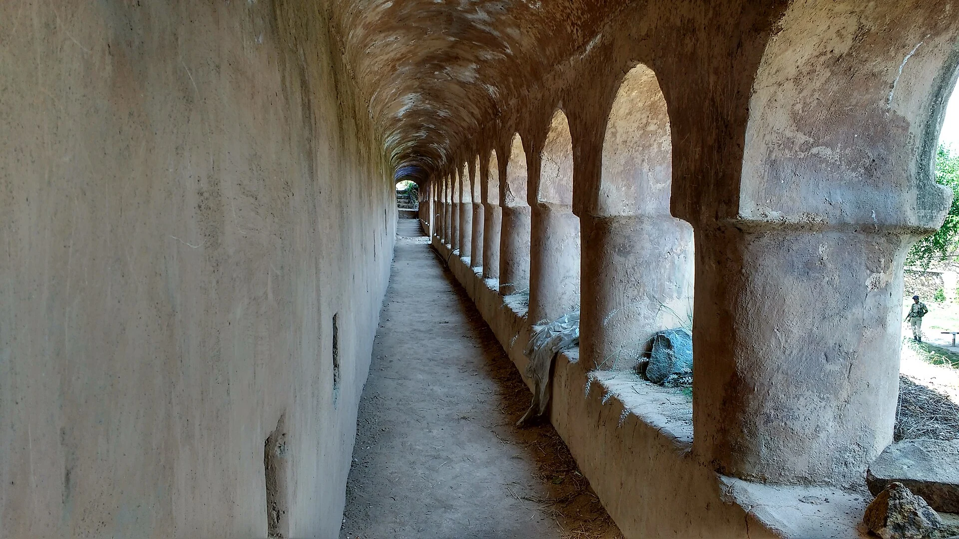
Hari Parbat Fort occupies the prominent hill also known as Koh-i-Maran above Srinagar. The hill, its outer fortifications and the summit fort are related but distinct features. A reader can see the silhouette from parts of the city without seeing the gateways or interior passages. The fort’s importance comes from that commanding landscape position as well as the historical periods represented by its surviving structures.[1]
Different phases of fortification
The secondary history distinguishes the outer wall associated with Emperor Akbar’s late-sixteenth-century project from the present summit fort associated with Afghan-period governor Atta Muhammad Khan in the early nineteenth century. This distinction prevents a common simplification in which every wall on Hari Parbat is described as one Mughal building. A hill can accumulate several episodes of defensive construction.[2]
The district’s destination profile identifies Hari Parbat as a fort overlooking the city and west of Dal Lake. It describes surviving apartments and substantial architectural remains. That overview locates the monument in Srinagar’s historical landscape, while the secondary chronology helps separate the periods of patronage. Neither account should be read as proving that every repaired surface is original to its earliest phase.[1]
Gateways, slopes and interior spaces
Kathi Darwaza and Sangin Darwaza are associated with approaches through the fortified city perimeter. The summit fort is above that lower wall system. Moving through a gateway at the foot of the hill is therefore not the same action as entering the high fort itself. Descriptions and map markers should identify which part of the ensemble is being discussed.[2]
The accompanying photograph shows an interior passage and repeated masonry openings rather than the fort’s familiar skyline. This is a useful reminder that a monument has more than one architectural face. A distant outline establishes position and mass; an interior view shows spaces, surfaces and the arrangement of openings at a human scale.
A hill shared by several traditions
The secondary geographical account places Sharika’s temple, Muslim shrines and Sikh gurdwaras around Hari Parbat. Their presence makes the hill a layered sacred landscape as well as a defensive landmark. The summit fort and these institutions have different histories and purposes even where they are seen within the same panorama. A shared hill does not merge them into one religious complex.[2]
A published heritage survey likewise treats Hari Parbat, Kathi Darwaza and Chatti Padshahi as separate sites within an urban network. This way of recording the landscape is useful: it retains the identity of each building while showing its geographical relationships with neighbouring places.[3]
Access to parts of a fortified site can change because of conservation or administrative arrangements. The historical description and map coordinate do not establish unrestricted entry to every enclosed space. The photograph is a record of a dated view, and current information should come from the relevant site authority.
Read Chatti Padshahi Gurdwara for a nearby institution and Shankaracharya Temple for another hilltop presence in Srinagar. Bahu Fort and Poonch Fort provide comparisons with different fortification histories in the Jammu region.
Photograph and map record
Photograph: Shibnaths2 via Wikimedia Commons. Licence: CC BY-SA 4.0. Recorded capture date: 2016-05-29 14:26:45. Resized and converted to WebP; scene content unchanged. This is a dated view, not confirmation of the site’s present appearance.
.jpg)
Map marker: 34.10527778, 74.81611111. Representative coordinate from the secondary geographical reference; not a surveyed boundary or a verified accessible entrance. View location on OpenStreetMap · View Google Maps · Google directions · OpenStreetMap directions.
Research checked: 14 October 2026. For a visit, confirm current access, transport and opening information with the relevant authorities. This encyclopedia profile provides geographical and historical context.
Sources & references
[1] Primary place or institutional account
https://srinagar.nic.in/tourist-place/hari-parbat-fort/ ↗
[2] Secondary historical and geographical reference
https://en.wikipedia.org/wiki/Hari_Parbat ↗
[3] Malik and colleagues — Primary urban heritage survey
Photograph and licence
https://commons.wikimedia.org/wiki/File:Hari_Parbat_Fort,_Srinagar_(2).jpg ↗
Related reading
Aali Masjid: Open Ground and a Historic Srinagar Mosque
Aali Masjid, also written Ali Masjid, is a historic mosque in Srinagar's Eidgah area.
Amar Singh College: Education, Campus Heritage and Institutional Change
The growth of an educational institution from a technical institute, with campus conservation and academic resources.
Bahu Fort: Jammu’s Riverside Fortification and Sacred Precinct
A fortified setting above the Tawi with a living Kali shrine and adjoining garden landscape.