
Rice Farming in Kashmir: Paddy Fields and Seasonal Work
Rice farming is an important part of Kashmir’s agricultural landscape and food system. Paddy cultivation connects seasonal field work with irrigation, planting, harvesting and grain processing. The crop is a cultivated grass, while the word paddy can refer to rice grown in fields or to grain still enclosed in its husk. These meanings describe different stages of the same crop.
Rice farming is an important part of Kashmir’s agricultural landscape and food system. Paddy cultivation connects seasonal field work with irrigation, planting, harvesting and grain processing. The crop is a cultivated grass, while the word paddy can refer to rice grown in fields or to grain still enclosed in its husk. These meanings describe different stages of the same crop. [1]
Fields and seasonal work
SKUAST-Kashmir publishes information on developed paddy varieties, showing the role of regional research in rice cultivation. Variety development is one part of farming, alongside the conditions of a particular field and the work required through the growing season. A named research variety should not be treated as a universal recommendation for every farm. [2]
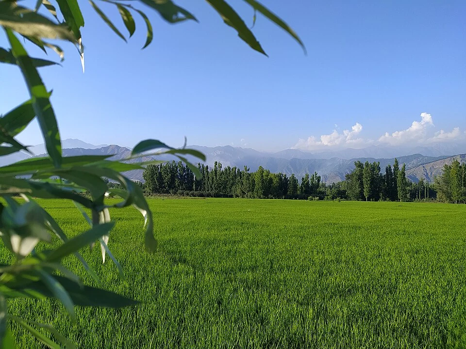
Water management helps distinguish a paddy field from a photograph of an ordinary green meadow. Bunds, channels and the arrangement of plots organize cultivation rather than simply decorating the landscape. Their function is easier to understand when the field is considered as a working production space.
From crop to food
Harvest does not immediately produce the rice served at a meal. Grain must be separated from the plant and processed, and milling removes the husk. This sequence connects the visible field with labour and facilities that may not appear in a scenic image. The photograph therefore records only one stage in the crop’s wider journey.
Rice also links agriculture with regional cooking. A food entry explains preparation and consumption; a farming entry explains how the ingredient is produced. Keeping these subjects connected but separate avoids treating agricultural work as merely a background illustration for cuisine.
Reading the landscape
Compare this profile with Kashmir’s walnut orchards, apple cultivation and the Ladakh barley entry. Different crops require different arrangements of land and work, so the appearance of one farm should not be applied to all regional agriculture. The Pulwama map marker is a labelled district context point rather than the location of every paddy field. A source photograph taken at Ladhoo or another named locality retains that location in its caption. No yield, planting date or input rate is supplied as a substitute for farm-specific agricultural advice.
Image and map record
Image: Yasir Yousuf Ahanger via Wikimedia Commons. Licence: CC BY-SA 4.0. Recorded capture date: 2020-07-23 18:29:08. Resized and converted to WebP; image content unchanged. This is a dated view, not confirmation of the site’s present appearance.
Map marker: 33.8741, 74.9001. Labelled regional/locality context marker; not a verified public entrance, pickup point, birthplace, residence, venue, trailhead, crop boundary or visitor route. View location on OpenStreetMap · View Google Maps · Google directions · OpenStreetMap directions.
Research checked: 15 October 2026. For a visit, confirm current access, transport and opening information with the relevant authorities. This encyclopedia profile provides geographical and historical context.
Sources & references
[1] Wikipedia: Rice (secondary overview)
https://en.wikipedia.org/wiki/Rice ↗
[2] SKUAST-Kashmir: paddy varieties
https://skuastkashmir.ac.in/Varieties.aspx?id=Paddy ↗
Image and licence
https://commons.wikimedia.org/wiki/File:Paddy_cultivation,_Ladhoo.jpg ↗
Related reading

Awantipora Temples: Avantivarman and the Archaeology of a Royal Town
The distinction between Avantiswami and Avantishwara and their association with Avantivarman’s royal town.
Barley in Ladakh: Cultivation and Regional Food Traditions
Barley is a cereal grass cultivated for its grain. In Ladakh it forms part of the relationship between farming, household food and a limited mountain
Buckwheat in Ladakh: Crop, Food and Mountain Fields
Buckwheat is a seed crop used like a cereal even though it is not a grass and is not closely related to wheat. Common buckwheat belongs to the knotwee