
Barley in Ladakh: Cultivation and Regional Food Traditions
Barley is a cereal grass cultivated for its grain. In Ladakh it forms part of the relationship between farming, household food and a limited mountain growing season. The botanical name Hordeum vulgare identifies the crop rather than a particular local variety. A regional farming account should distinguish the species from the different practices used to cultivate and process it.
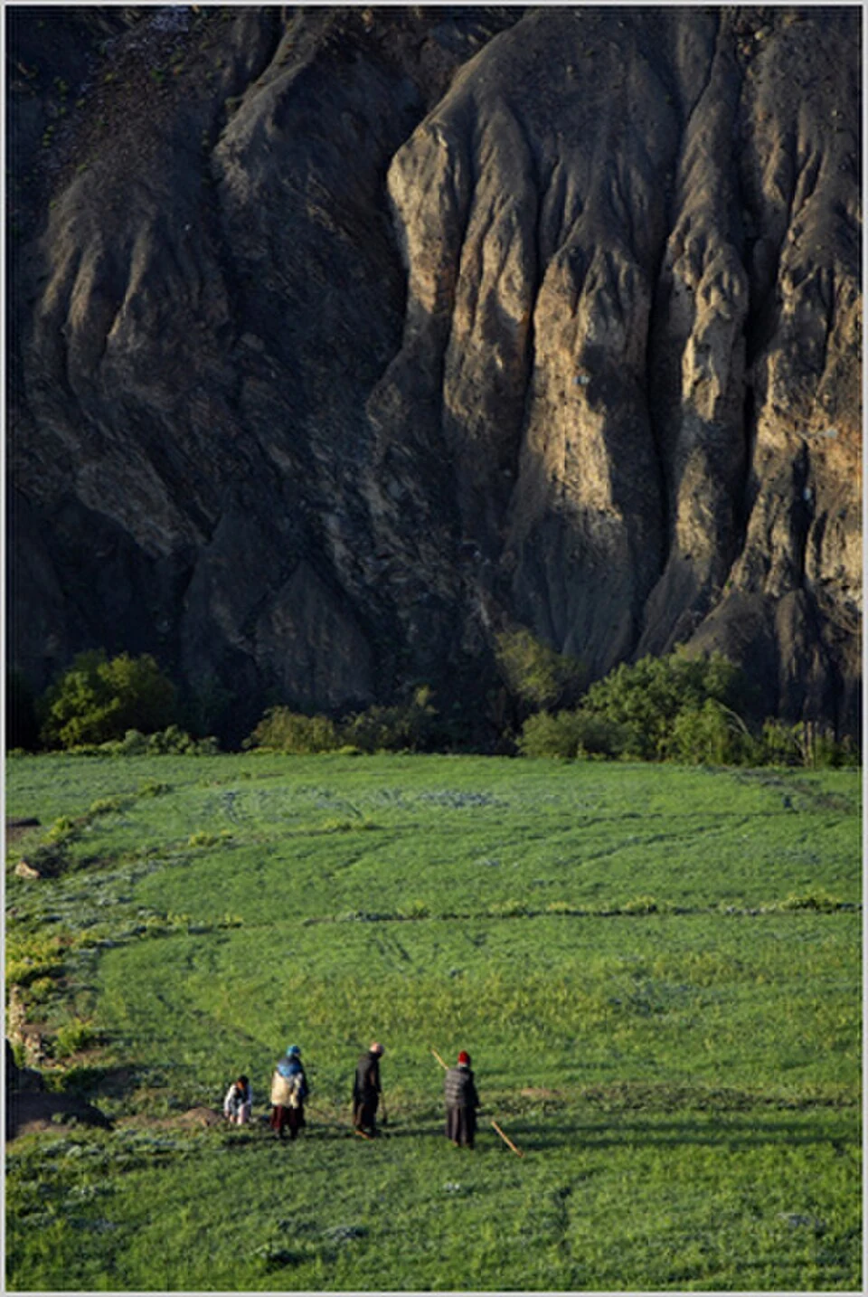
Barley is a cereal grass cultivated for its grain. In Ladakh it forms part of the relationship between farming, household food and a limited mountain growing season. The botanical name Hordeum vulgare identifies the crop rather than a particular local variety. A regional farming account should distinguish the species from the different practices used to cultivate and process it. [1]
Cultivated landscapes
Agricultural literature on Ladakh describes barley within the region’s crop heritage. This places the grain alongside other cultivated plants rather than treating the mountain landscape as entirely uncultivated. Fields, water distribution and settlement work belong to the same inhabited environment as the more frequently photographed monasteries and mountains. [2]
The growing season is only one part of a farming system. Preparing land, obtaining water and organizing labour all contribute to a crop’s production. A general account of Ladakh cannot determine the precise conditions of an individual plot, so cultivation instructions need local, dated agricultural guidance.
From field to stored grain
A harvested cereal passes through several stages before use. Separating grain from the plant and keeping it in suitable storage connect field work with later consumption. A museum storage vessel can illustrate this agricultural history, provided its caption describes the object rather than pretending to document a present household’s practices.
Barley and buckwheat can both appear in accounts of Ladakh’s food, but they belong to different plant groups. Comparing them makes the distinction between a true cereal and a pseudocereal concrete. Apricot orchards add another contrast because a perennial tree crop has a different production cycle from a grain field.
Landscape and interpretation
Use the Leh context marker as a regional reference, not as the location of a specific barley field. The accompanying photograph identifies its actual place and subject, whether a documented Ladakh farming scene or an explicitly representative botanical image. Reading fields as working spaces helps explain settlement life more fully than describing them only as scenic colour. The crop’s regional significance can be discussed without attaching an unsupported yield, assuming uniform varieties or presenting a dated study as a current prescription for every farmer.
Image and map record
Image: nevil zaveri from navsari (guj), india via Wikimedia Commons. Licence: CC BY 2.0. Recorded capture date: 2010-06-06 05:58. Resized and converted to WebP; image content unchanged. This is a dated view, not confirmation of the site’s present appearance.
Map marker: 34.165, 77.585. Labelled regional/locality context marker; not a verified public entrance, pickup point, birthplace, residence, venue, trailhead, crop boundary or visitor route. View location on OpenStreetMap · View Google Maps · Google directions · OpenStreetMap directions.
Research checked: 15 October 2026. For a visit, confirm current access, transport and opening information with the relevant authorities. This encyclopedia profile provides geographical and historical context.
Sources & references
[1] Wikipedia: Barley (secondary overview)
https://en.wikipedia.org/wiki/Barley ↗
[2] Asian Agri-History: traditional agriculture and crop heritage in Ladakh
https://www.asianagrihistory.org/pdf/volume13/1.pdf ↗
Image and licence
Related reading
Buckwheat in Ladakh: Crop, Food and Mountain Fields
Buckwheat is a seed crop used like a cereal even though it is not a grass and is not closely related to wheat. Common buckwheat belongs to the knotwee
Chang La: A High Pass on the Route towards Pangong
Chang La is a high mountain pass in Ladakh on the road corridor towards Durbuk, Tangtse and Pangong. It connects the Leh-side approaches through Karu
Gurdwara Pathar Sahib: Sikh Tradition in the Indus Valley
Gurdwara Pathar Sahib is a Sikh place of worship in the Indus-valley corridor west of Leh.