
Pir Ki Gali: Mountain Pass and the Mughal Road Connection
The Pir Panjal pass linking the Shopian and Poonch sides of the Mughal Road corridor.
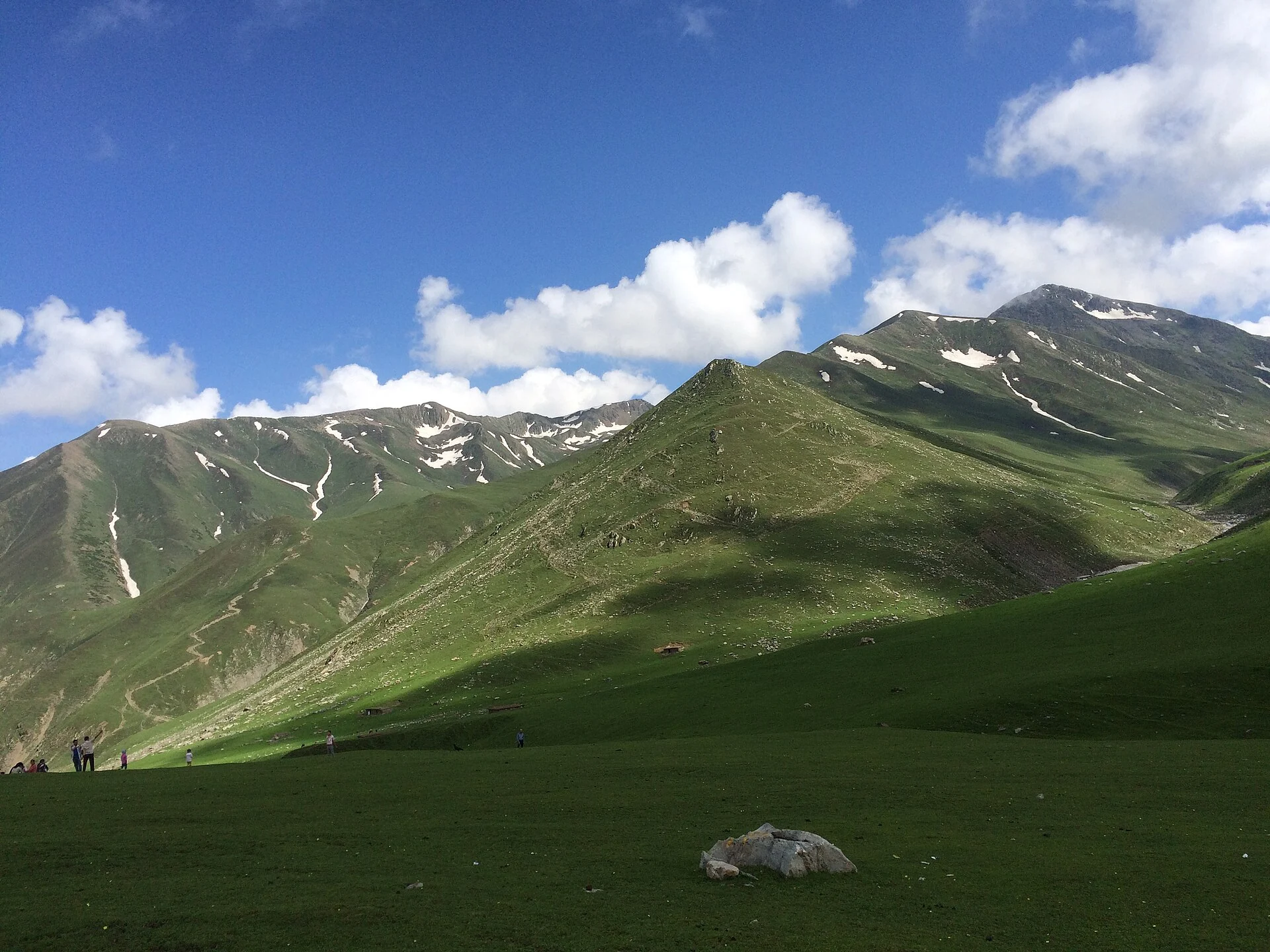
Pir Ki Gali, also written Peer Ki Gali or Peer Gali, is a mountain pass in the Pir Panjal range. It is a principal high point on the Mughal Road connecting the Kashmir side around Shopian with the Poonch and Rajouri region. This encyclopedia uses Shopian as the article’s primary district filter, while keeping its cross-regional role explicit. A pass is a connection across a mountain barrier, not a settlement contained within a single lowland street address.[1]
Landscape and the road corridor
The Shopian administration places the pass at approximately 3,490 metres and identifies it as the Mughal Road’s highest point. That figure concerns the pass, not every place along the road. The surrounding slopes, open high ground and changing snow conditions give the corridor a different physical character from roads on the Kashmir Valley floor. A route’s existence on a map is separate from its availability in particular weather.[1]
Poonch’s description of the Mughal Road identifies the connection from Bufliaz towards Shopian and names several places along it. It places Pir Ki Gali between the two ends of this corridor and associates it with surrounding meadows and mountains. This account is valuable because it views the same pass from the opposite regional approach, showing how one landmark can link communities rather than belong exclusively to one destination’s promotional story.[3]
Historical route and modern road
The secondary pass reference connects the route with travel between the Kashmir Valley and the Jammu-side hills. It discusses the association with Mughal-era journeys and the later development of the motor road. Those are related histories but not the same event: a historic passage over a mountain does not mean that the present engineered road, bridges and retaining works are unchanged remnants of an imperial route.[2]
The modern name “Mughal Road” preserves a historical association while describing a contemporary transport corridor. Road building changes the way a pass functions: it brings vehicles, maintenance and travel decisions into ground previously crossed in different ways. Reading that change alongside the landscape is more informative than assuming that a famous historical traveller’s journey can be repeated under identical conditions today.
A name with devotional associations
The secondary account describes the local association of the pass with a revered spiritual figure and a shrine. This devotional layer helps explain the name and the place’s significance to people using the road. A shrine at a pass and the road itself have different purposes, even though travellers may encounter both. Religious traditions should be identified as traditions, rather than used as evidence for an exact date of road construction.[2]
The photograph records a view of the high pass landscape. It does not establish that the road is open on the reader’s chosen day. Snow clearance, slope conditions and current traffic instructions are operational information that must come from the responsible authorities. The representative marker locates the pass; it is not a surveyed lay-by or a guaranteed stopping location.
Read Poonch Fort for an urban heritage site on the Jammu-side regional connection. Sonamarg introduces a different mountain corridor, and Sanasar offers another upland village landscape. These comparisons retain the different histories and physical settings of each place.
Photograph and map record
Photograph: Garvbhargav via Wikimedia Commons. Licence: CC BY-SA 4.0. Recorded capture date: Taken on 3 July 2016, 15:54:34. Resized and converted to WebP; scene content unchanged. This is a dated view, not confirmation of the site’s present appearance.

Map marker: 33.629931, 74.519968. Representative coordinate from the secondary geographical reference; not a surveyed boundary or a verified accessible entrance. View location on OpenStreetMap · View Google Maps · Google directions · OpenStreetMap directions.
Research checked: 14 October 2026. For a visit, confirm current access, transport and opening information with the relevant authorities. This encyclopedia profile provides geographical and historical context.
Sources & references
[1] Primary place or institutional account
https://shopian.nic.in/tourist-place/peer-kigali/ ↗
[2] Secondary historical and geographical reference
https://en.wikipedia.org/wiki/Pir_Panjal_Pass ↗
[3] District Poonch — Mughal Road and Pir Ki Gali
https://poonch.nic.in/tourist-place/mughal-road-pir-ki-gali/ ↗
Photograph and licence
https://commons.wikimedia.org/wiki/File:Peer_Ki_Gali,_Mughal_Road_,_J%26K.jpg ↗