
Rajouri: River Valleys, Historic Town and Regional Connections
Rajouri is the headquarters town of Rajouri district in Jammu and Kashmir's Jammu division.
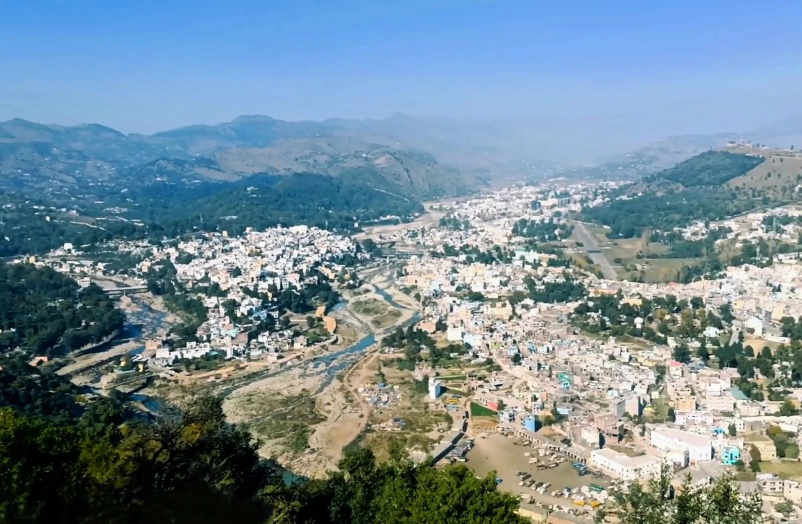
Rajouri is the headquarters town of Rajouri district in Jammu and Kashmir's Jammu division. Its history is often introduced through the older name Rajapuri. Today, the town is best understood as both a settlement within a hilly river landscape and a centre serving surrounding communities. District boundaries, municipal limits and the built-up town describe different geographical units; facts about one should not automatically be transferred to another.[1]
Town and district
The district administration explains that the district takes its name from Rajouri town and records the division of the former Poonch district in September 1967. That administrative event is a useful reference point for the modern district, not the beginning of the settlement's history. Older historical names and accounts of regional kingdoms concern a much longer period and need to be read with attention to their sources.[2]
The difference matters when using population figures. A district total includes villages and other towns, while a municipal census concerns a smaller area at a stated date. A number without a year and geographical definition can create a false picture of Rajouri. The same care is needed with road distances: a route between two headquarters is not a measurement of the whole district.
A regional centre with several histories
Rajouri's official tourism material identifies places of worship and remembrance around the town, including a gurdwara, mosques and temples. Its list places these within a shared urban geography while recognising their separate identities. This makes the town a useful starting point for studying the Jammu hills through institutions and neighbourhoods rather than through scenery alone.[3]
That approach also leaves room for ordinary urban life. Markets, educational institutions and district services can be investigated as individual subjects, with their own records and locations. A university campus outside the centre should not be conflated with the municipal town, and a district attraction should not be presented as a short walk away merely because both carry the Rajouri name.
For regional comparisons, read about Poonch Fort, another place where town history and built heritage meet, and Pir Ki Gali, which places the western Jammu hills in a wider mountain-road context. These connections explain relationships between places without treating them as a single itinerary.
Photograph and map record
Photograph: Muslimah Pahari01 via Wikimedia Commons. Licence: CC BY-SA 4.0. Recorded capture date: 2023-07-13. Resized and converted to WebP; scene content unchanged. This is a dated view, not confirmation of the site’s present appearance.

Map marker: 33.37666667, 74.31222222. Representative location from the secondary geographical record, not a surveyed boundary or verified visitor entrance. View location on OpenStreetMap · View Google Maps · Google directions · OpenStreetMap directions.
Research checked: 14 October 2026. For a visit, confirm current access, transport and opening information with the relevant authorities. This encyclopedia profile provides geographical and historical context.
Sources & references
[1] Rajouri — secondary historical/geographical overview
https://en.wikipedia.org/wiki/Rajouri ↗
[2] Rajouri district: historical and administrative profile
https://rajouri.nic.in/about-district/ ↗
[3] Rajouri district: tourism and urban places
https://rajouri.nic.in/tourism/ ↗
Photograph and licence
https://commons.wikimedia.org/wiki/File:Rajouri_city_skyline_photo.jpg ↗
Related reading
Basohli: Ravi-side Town and a Centre of Pahari Painting
Basohli is a town in Kathua district, in the Jammu region, overlooking the Ravi river landscape.
Bhaderwah: Town, Valley and the Bhadarwahi Cultural Landscape
The mountain town and valley, local language identity and relationship with surrounding destinations.
Drass: Mountain Settlement on the Srinagar–Ladakh Corridor
Drass, also written Dras, is a mountain settlement on the road corridor between the Kashmir Valley and Kargil.