
Khardung La: A Pass Connecting Leh and Nubra
Khardung La is a high mountain pass north of Leh that links the Indus-valley side with the Shyok and Nubra corridors. Its road crossing is a well-known part of Ladakh's transport landscape. The pass and a promotional claim about the world's highest road should be treated as separate subjects.
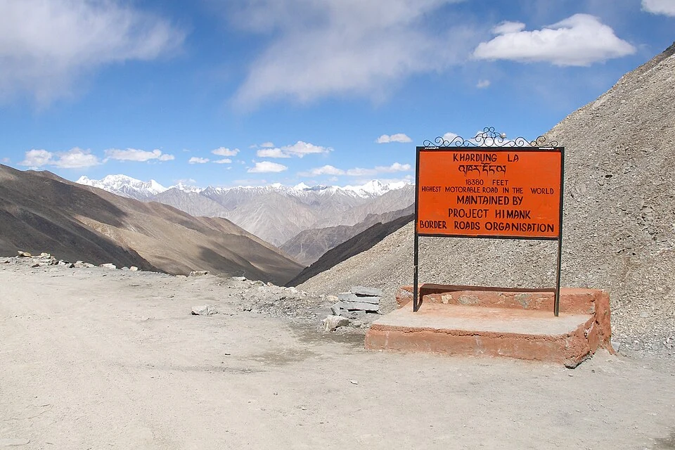
Khardung La is a high mountain pass north of Leh that links the Indus-valley side with the Shyok and Nubra corridors. Its road crossing is a well-known part of Ladakh's transport landscape. The pass and a promotional claim about the world's highest road should be treated as separate subjects.[1]
Connection between valleys
Reference accounts place the pass in the Ladakh Range and give an elevation around 5,359 metres. Older signs and tourist descriptions sometimes state a higher figure. The difference should be acknowledged rather than concealed by reproducing the sign as an exact survey record.[1]
The Leh administration includes Khardung La within its tourism and adventure information. Its gateway role helps explain the connection between Leh and Nubra. A visitor-route description is useful geographical context but does not verify the present condition of every road section.[2]
Height and superlatives
“Highest motorable road” claims change with new roads, definitions and measurements. A pass can remain important without holding a global ranking. Its relationship with settlements, valleys and travel is a stronger encyclopedia description than an undated superlative.
A source photograph may show a board containing such a claim. Retaining that board in an unaltered photograph documents the sign; it does not mean the article endorses every statement printed on it. Caption and prose can make that distinction explicit.
The crossing's height also makes lowland assumptions about travel inappropriate. This geographical profile does not prescribe medical limits or a universal time to remain at the summit. Personal planning and current conditions need appropriate local and professional information.
Read Diskit, Hunder and Nubra River for the northern valley setting. Chang La covers a different high crossing. The map points to Khardung La for orientation, not an approved stopping area or confirmation that a vehicle can currently cross. A historical road photograph is not a live travel advisory.
Image and map record
Image: Vyacheslav Argenberg via Wikimedia Commons. Licence: CC BY 4.0. Recorded capture date: 2007-09-16 14:07:07. Resized and converted to WebP; image content unchanged. This is a dated view, not confirmation of the site’s present appearance.
,_Ladakh,_North_India.jpg)
Map marker: 34.27833333, 77.60416667. Source-recorded location for orientation; not a surveyed boundary, verified public entrance, current access guarantee or authorised stopping point. View location on OpenStreetMap · View Google Maps · Google directions · OpenStreetMap directions.
Research checked: 14 October 2026. For a visit, confirm current access, transport and opening information with the relevant authorities. This encyclopedia profile provides geographical and historical context.
Sources & references
[1] Reference overview: Khardung La
https://en.wikipedia.org/wiki/Khardung_La ↗
[2] Leh administration: adventure and road-corridor geography
https://leh.nic.in/tourism/adventures/ ↗
Image and licence
https://commons.wikimedia.org/wiki/File:Khardung_La_(mountain_pass),_Ladakh,_North_India.jpg ↗
Related reading
Barley in Ladakh: Cultivation and Regional Food Traditions
Barley is a cereal grass cultivated for its grain. In Ladakh it forms part of the relationship between farming, household food and a limited mountain
Chang La: A High Pass on the Route towards Pangong
Chang La is a high mountain pass in Ladakh on the road corridor towards Durbuk, Tangtse and Pangong. It connects the Leh-side approaches through Karu
Fotu La: A High Pass on Ladakh’s Western Road Corridor
Fotu La, also written Fatu La, is a mountain pass on the Srinagar–Leh road corridor in western Ladakh. It lies near the approach to Lamayuru and forms