
Fotu La: A High Pass on Ladakh’s Western Road Corridor
Fotu La, also written Fatu La, is a mountain pass on the Srinagar–Leh road corridor in western Ladakh. It lies near the approach to Lamayuru and forms a prominent high point between the Kargil and Indus-valley settings. The pass should be distinguished from the surrounding range and from the entire highway.
Fotu La, also written Fatu La, is a mountain pass on the Srinagar–Leh road corridor in western Ladakh. It lies near the approach to Lamayuru and forms a prominent high point between the Kargil and Indus-valley settings. The pass should be distinguished from the surrounding range and from the entire highway.[1]
Pass and road sequence
Reference accounts place Fotu La at approximately 4,108 metres and identify it as a high point on this particular highway corridor. That statement is about a named route, not a claim that it is the world's highest pass or motorable road. Elevation figures should retain their source and level of precision.[1]
The Kargil administration identifies Fotu La among the gateways connecting its region with Leh. Its published elevation differs from common reference figures. This profile uses an approximate height and preserves the distinction between sources rather than suggesting that the competing numbers are one exact survey measurement.[2]
Terrain and viewpoint
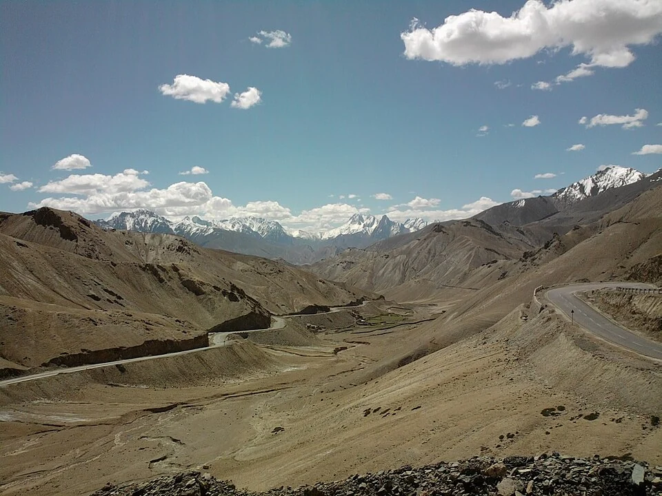
The road's ascent and descent can be read through the surrounding slopes, but a photograph of the pass is only one view of that terrain. A signboard marks a named stop, whereas the wider pass includes the ground around the crossing.
Road condition is a separate, time-sensitive subject. A summer image showing clear asphalt cannot establish access in another season. Likewise, a map-generated route may recognise the road without having current information about restrictions or maintenance.
The pass belongs to an inhabited regional corridor, with villages and monasteries at different points along the route. Connecting those places helps explain why a crossing matters beyond a roadside photograph.
Read Lamayuru Monastery, Namika La and Khaltse for nearby and sequential geography. This article files Fotu La under Sham in the current district framework; older sources often use Leh. The source-recorded pass viewpoint supplies orientation, not a district boundary, verified lay-by or confirmation of current traffic conditions.
Image and map record
Image: Mormegil241 via Wikimedia Commons. Licence: CC BY-SA 3.0. Recorded capture date: 2010-05-30. Resized and converted to WebP; image content unchanged. This is a dated view, not confirmation of the site’s present appearance.

Map marker: 34.29071, 76.710285. Source-recorded camera viewpoint at Fotu La; not a current approved vehicle stopping point. View location on OpenStreetMap · View Google Maps · Google directions · OpenStreetMap directions.
Research checked: 14 October 2026. For a visit, confirm current access, transport and opening information with the relevant authorities. This encyclopedia profile provides geographical and historical context.
Sources & references
[1] Reference overview: Fotu La
https://en.wikipedia.org/wiki/Fotu_La ↗
[2] Kargil administration: Fotu La gateway and published height
https://kargil.nic.in/about-district/ ↗
Image and licence
Related reading
Alchi: Painted Temples and the Art of Western Himalayan Buddhism
Alchi is a Buddhist temple complex in the lower Indus valley, known especially for its painted interiors, sculpture and carved woodwork.
Chang La: A High Pass on the Route towards Pangong
Chang La is a high mountain pass in Ladakh on the road corridor towards Durbuk, Tangtse and Pangong. It connects the Leh-side approaches through Karu
Khaltse: Indus Crossing and Headquarters of Sham
Khaltse, also spelt Khalatse or Khalsi, is an Indus-valley settlement on the road corridor linking Leh and Kargil.