
Pangong Tso: A Transboundary High-altitude Lake
Pangong Tso is an elongated, high-altitude lake extending across eastern Ladakh and the Tibetan plateau.
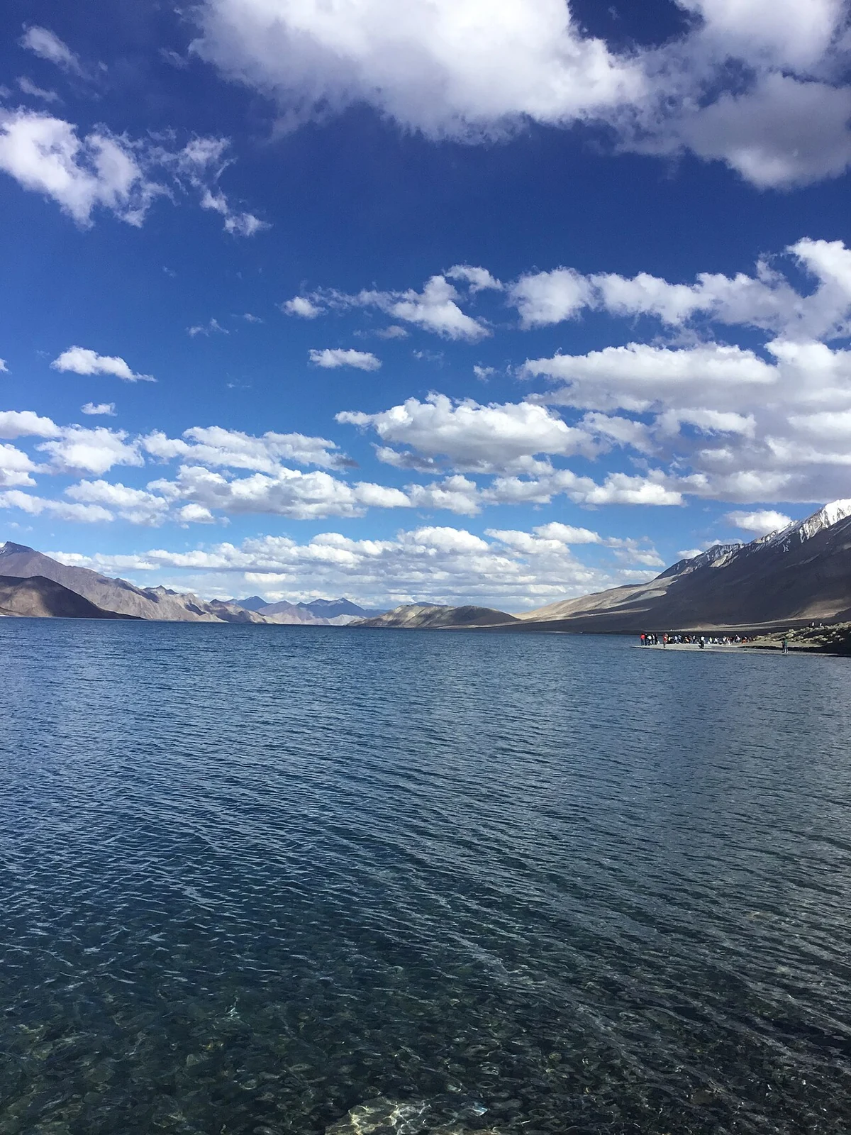
Pangong Tso is an elongated, high-altitude lake extending across eastern Ladakh and the Tibetan plateau. It occupies a closed drainage basin: water collects within the basin rather than flowing onward through an ordinary river outlet. Its water is saline or brackish, and the lake freezes during winter. The changing blue and green appearance familiar from photographs is a visual characteristic, not evidence that the lake is tropical or freshwater.[1]
One lake across a contested boundary
The lake crosses areas administered by India and China, and the Line of Actual Control passes through it. The boundary situation is disputed, so a geographical description should distinguish administration from sovereignty claims. This encyclopedia's Changthang district filter applies to its Indian-administered Ladakh context, not to the entire transboundary lake.[1]
The official district description gives a length of about 134 kilometres and a maximum width around five kilometres. Those figures concern the larger lake, not the road-accessible frontage at a particular settlement. Sources differ in some dimensions and in translated meanings of the name; approximate measurements are more appropriate than false precision for an introductory profile.[2]
Water, shore and mountain setting
A closed lake basin can accumulate dissolved salts as water evaporates. The lake's visible surface is only one part of its system: inflowing streams, shoreline wetlands and the surrounding catchment also matter. The contrast between open water and arid mountains is striking, but it should not lead to the assumption that all shores have the same ecology or accessibility.
A lakeside photograph records one viewpoint and set of conditions. It cannot establish a current water level, a safe swimming area or the status of a road beyond the frame. The marker provided with this article is a representative point near the western Ladakh shore, rather than the centre of the whole lake or a route across it. Map directions remain subject to road and access restrictions.
For comparison, see Tso Moriri, a separate protected lake and wetland, and Tso Kar, where saline and freshwater components form a wetland complex. The Hanle entry places another Changthang settlement within a different valley. These are regional relationships, not evidence that the places are close together or share identical visitor rules.
Photograph and map record
Photograph: ThePoeticFrame via Wikimedia Commons. Licence: CC BY-SA 4.0. Recorded capture date: 2021-07-13 17:31:42. Resized and converted to WebP; scene content unchanged. This is a dated view, not confirmation of the site’s present appearance.

Map marker: 34.002258, 78.413032. Representative camera-location point overlooking the western shore near Lukung, from a dated Commons location record; not the lake centre, a boundary or an authorised access point. View location on OpenStreetMap · View Google Maps · Google directions · OpenStreetMap directions.
Research checked: 14 October 2026. For a visit, confirm current access, transport and opening information with the relevant authorities. This encyclopedia profile provides geographical and historical context.
Sources & references
[1] Pangong Tso — secondary historical/geographical overview
https://en.wikipedia.org/wiki/Pangong_Tso ↗
[2] Leh district archive: Pangong Lake
https://leh.nic.in/tourist-place/pangong/ ↗
[3] Commons location record for a dated western-shore view
Photograph and licence
https://commons.wikimedia.org/wiki/File:A_view_of_Pangong_Lake.jpg ↗
Related reading
Black-necked Crane: Wetland Breeding Habitat in Ladakh
The black-necked crane is an important bird of Ladakh's high-altitude wetland landscapes.
Dal Lake: Waterways, Floating Gardens and Life on the Lake
An introduction to Dal Lake’s connected basins, working waterscape, floating gardens, boats and cultural setting.
Hanle: Settlement, Monastery and the High-altitude Night Sky
Hanle is a settlement in the high-altitude Changthang region of Ladakh, in the valley of the Hanle river.