
Bhaderwah: Town, Valley and the Bhadarwahi Cultural Landscape
The mountain town and valley, local language identity and relationship with surrounding destinations.
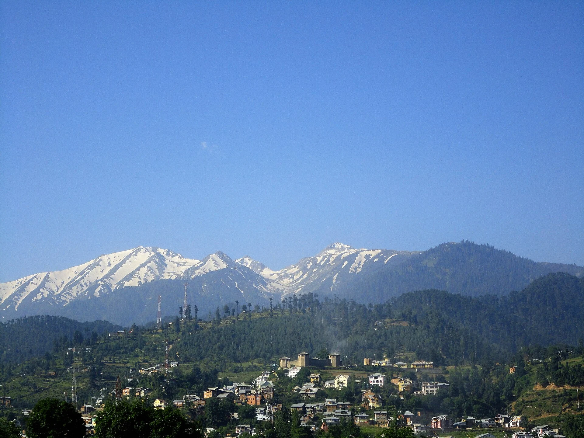
Bhaderwah, also written Bhadarwah, is a town and surrounding valley area in Doda district. It belongs to the Jammu region’s mountain settlement geography and has a distinctive cultural association with the Bhadarwahi language and local traditions. The town is an inhabited centre with administrative and commercial functions, while the wider valley contains villages, wooded slopes and higher-ground destinations.[2]
Town and surrounding landscape
Doda’s tourism directory identifies Jai Valley, Padri and Telli Garh within the wider Bhaderwah destination landscape. These are separate places rather than different names for the town centre. The distinction is useful when reading a map: a visitor can reach Bhaderwah town without thereby reaching every meadow, ridge or neighbouring valley included in a regional tourism list.[1]
The secondary town account describes a mountain setting and a cultural history extending beyond modern recreation. The spelling variations reflect different ways of representing the place name in English. They do not generally identify separate settlements. Retaining the main alternate spelling in the search tags helps connect records that use Bhadarwah with those using Bhaderwah.[2]
Language and local identity
Bhadarwahi is an important part of the town’s cultural identity, alongside other languages used in the region. A geographical profile should recognise language as part of everyday life, not merely as a statistic in a district table. Songs, local performance and remembered place names provide a different view of the landscape from the terminology of a visitor itinerary.[2]
This article does not treat the entire Doda district as culturally identical to Bhaderwah. A town and its valley have their own local associations within a much wider mountain region. More detailed language, festival and village entries can develop those subjects without requiring a town overview to speak for every community.
Tourism within a working landscape
A district report from December 2019 records the inauguration of tourism projects in the town and its surroundings. It discusses the development of infrastructure and routes. That report is evidence of a particular phase in tourism development, rather than a current inventory showing that every project or service mentioned operates today.[3]
The landscape photograph records a view of settlement below mountain slopes. Buildings and cultivated or wooded ground belong in the same picture as the peaks. This makes Bhaderwah a useful example of how scenic value and everyday habitation coexist. A place can attract visitors without becoming an uninhabited backdrop detached from its residents’ lives.
Reading regional connections
The town marker is for Bhaderwah, not for all surrounding destinations. A current journey should use the actual chosen place and present road information. Fixed journey times, seasonal activity claims and an undated promise that every route is open would add little reliable value to a historical and geographical profile.
Compare Kishtwar town for another mountain settlement in the upper Chenab region and Sanasar for a smaller upland village landscape. Lolab Valley and Pahalgam offer comparisons across the encyclopedia’s wider regional scope while preserving their different cultural and geographical settings.
Photograph and map record
Photograph: KaranKapoor1314 via Wikimedia Commons. Licence: CC BY-SA 4.0. Recorded capture date: 2012-06-15 20:24:26. Resized and converted to WebP; scene content unchanged. This is a dated view, not confirmation of the site’s present appearance.

Map marker: 32.980033, 75.713706. Representative coordinate from the secondary geographical reference; not a surveyed boundary or a verified accessible entrance. View location on OpenStreetMap · View Google Maps · Google directions · OpenStreetMap directions.
Research checked: 14 October 2026. For a visit, confirm current access, transport and opening information with the relevant authorities. This encyclopedia profile provides geographical and historical context.
Sources & references
[1] Primary place or institutional account
https://doda.nic.in/tourist-places/ ↗
[2] Secondary historical and geographical reference
https://en.wikipedia.org/wiki/Bhaderwah ↗
[3] District Doda — Tourism infrastructure event, December 2019
Photograph and licence
Related reading
Basohli: Ravi-side Town and a Centre of Pahari Painting
Basohli is a town in Kathua district, in the Jammu region, overlooking the Ravi river landscape.
Drass: Mountain Settlement on the Srinagar–Ladakh Corridor
Drass, also written Dras, is a mountain settlement on the road corridor between the Kashmir Valley and Kargil.
Gulmarg: Meadow, Resort History and Winter Sports
A connected profile of Gulmarg’s upland meadow, historical patronage, recreational landscape and winter sports.