
Srinagar International Airport: Civil Gateway, History and Passenger Information
Srinagar Airport’s Budgam location, civil-enclave arrangement, historical milestones and official sources for passenger information.
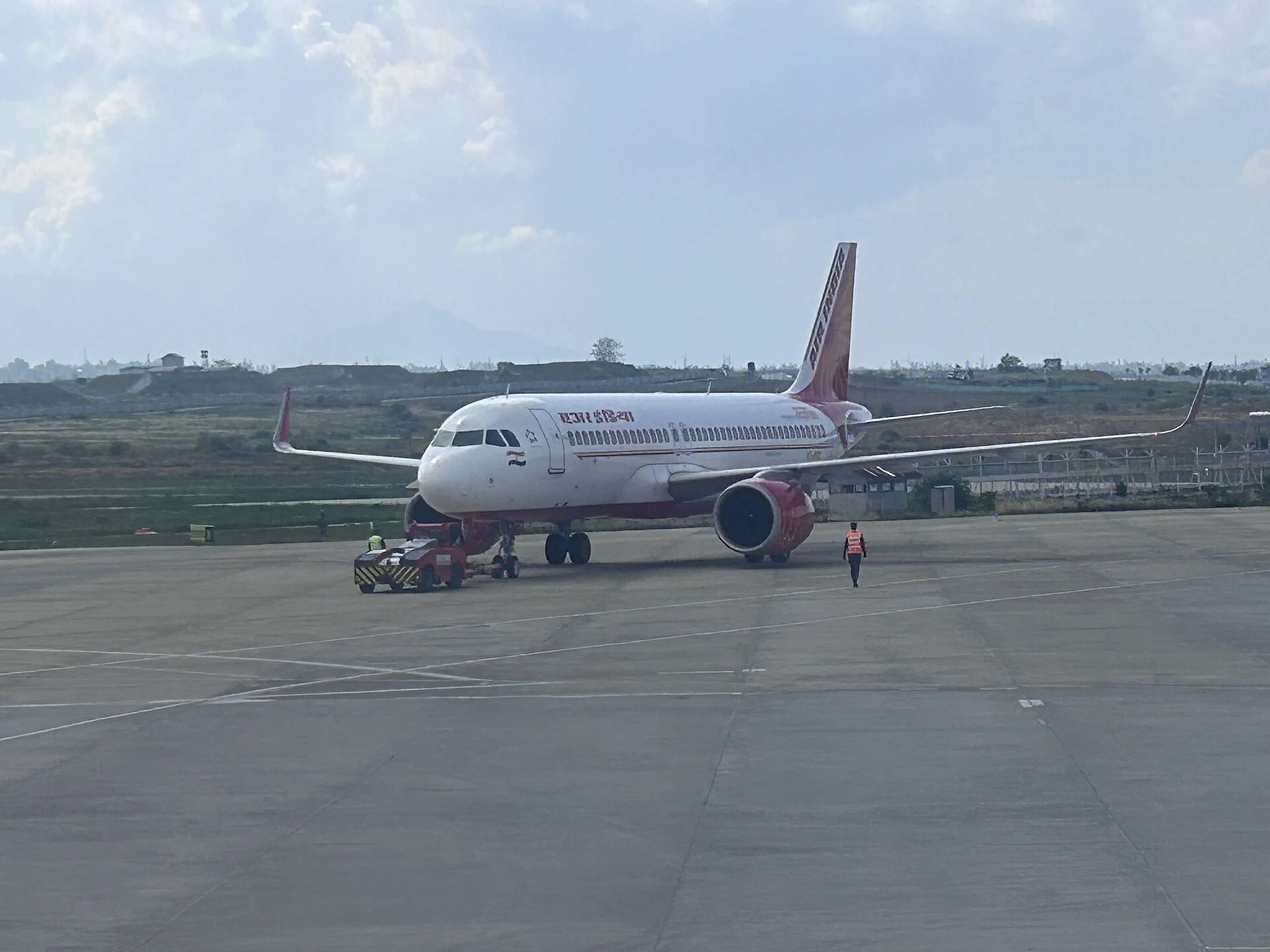
Srinagar International Airport is the principal airport serving Srinagar and an important air gateway to the Kashmir Valley. Its IATA code is SXR and its ICAO location indicator is VISR. The airport is situated in Budgam district, even though its name and principal service relationship are with Srinagar. That distinction is useful in a geographical encyclopedia: the city served by a transport facility and the district containing it need not be identical.[1]
The airport combines a military airfield with a civil enclave operated by the Airports Authority of India. It is consequently more precise to describe the AAI passenger facilities as the civil part of a larger airfield than to assume that every building and operational area has the same administrative role. This arrangement underlies the separation between a passenger’s terminal journey and the aviation infrastructure supporting aircraft movements.[2]
Names and the airport’s public identity
AAI uses the title Srinagar International Airport. Sheikh ul-Alam International Airport is another familiar name, associated with Sheikh Noor-ud-din Noorani. The secondary reference distinguishes common usage from the formal status of the proposed naming. This entry uses AAI’s title, with the alternative included in its search tags.[1]
A civil gateway within an airfield
The secondary history dates the civil enclave’s opening to 1979 and international designation to 2005. These events describe changes in the airport’s civil function and designation. They do not establish that international scheduled flights to every overseas destination are available today. The word “international” in an airport’s title is different from an airline’s current route network, and route claims require a dated timetable or airline source.[1]
AAI’s airport profile identifies domestic and international terminal functions, boarding and passenger infrastructure, and airport management contacts. Such a profile is useful for understanding the role of the terminal. Capacity figures are less useful when copied without the date and operating assumptions behind them. This entry therefore does not turn a published terminal capacity into a statement about the number of people passing through the building at any particular hour.[3]
Finding the right information as a passenger
AAI publishes a separate conveniences page for Srinagar’s passenger services. The distinction between airport information and airline information is practical: a facility listing concerns the terminal, whereas baggage allowance, check-in conditions and rebooking normally belong to the airline’s own rules. A readable airport profile should help readers identify the appropriate source rather than provide a fixed set of travel conditions that may later change.[4]
The official airport profile directs lost-and-found baggage enquiries to the Duty Terminal Manager. A lost object in a terminal and a checked bag that has not arrived are different situations, so the relevant airport or airline channel should be identified before treating every issue as one category of “lost baggage”. The profile’s current contact page is preferable to an old telephone number copied into an article and left without a review date.[3]
The map is a reference, not an entrance plan
The aeronautical information publication identifies VISR and records an aerodrome reference point. That coordinate is intended to describe the airfield geographically. It is not a passenger drop-off point or permission to enter an operational area. The map attached to this article uses that published reference for orientation, while directions to the passenger terminal should be confirmed through the airport’s actual road entrance and local access arrangements.[5]
This distinction matters for any transport article. A runway, an apron, a terminal building and an access gate are different spaces with different purposes. The photograph accompanying this entry shows an aircraft on the apron in April 2026. It documents a view of airport operations at a particular moment; it does not prove the availability of the pictured aircraft’s route on a later day or show the route a passenger should take through the terminal.
The airport’s regional importance can be followed through entries on Gulmarg, Pahalgam and Sonamarg. Those destinations involve onward road travel rather than being part of the airport. The Srinagar district profile provides the urban and regional setting.
Photograph and map record
Photograph: Harvinder Chandigarh via Wikimedia Commons. Licence: CC BY 4.0. Recorded capture date: 2026-04-20 15:00:00. Resized and converted to WebP; scene content unchanged. This is a dated view, not confirmation of the site’s present appearance.

Map marker: 33.98777777777778, 74.77444444444444. Aerodrome reference point from the cited AAI eAIP edition. This is an airfield locator, not a public entrance or passenger drop-off point; choose the actual terminal entrance for travel. View location on OpenStreetMap · View Google Maps · Google directions · OpenStreetMap directions.
Research checked: 14 October 2026. For a visit, confirm current access, transport and opening information with the relevant authorities. This encyclopedia profile provides geographical and historical context.
Sources & references
[1] Srinagar Airport — Secondary location, history and name reference
https://en.wikipedia.org/wiki/Srinagar_Airport ↗
[2] Press Information Bureau — Historical civil-enclave development statement
https://www.pib.gov.in/newsite/erelcontent.aspx?lang=2®=48&relid=6762 ↗
[3] Airports Authority of India — Airport profile and contact information
https://www.aai.aero/en/node/92467 ↗
[4] Airports Authority of India — Srinagar passenger conveniences
https://www.aai.aero/en/airports/passenger-info/srinagar/Conveniences ↗
[5] AAI Aeronautical Information Publication — VISR reference coordinates, cited edition
https://aim-india.aai.aero/eaip/eaip-v2-05-2025/eAIP/IN-AD%202.1VISR-en-GB.html ↗
Photograph and licence
https://commons.wikimedia.org/wiki/File:Srinagar_International_Airport_,_J_%26_K_,_India_._01.jpg ↗