
Jammu Airport: Civil Aviation in the Tawi Plain
Jammu Airport, identified by the IATA code IXJ, serves Jammu city and the surrounding region.
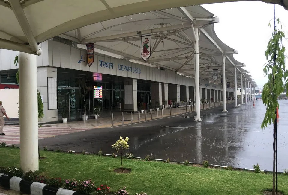
Jammu Airport, identified by the IATA code IXJ, serves Jammu city and the surrounding region. The Airports Authority of India lists the passenger facility as the Civil Enclave at Jammu. This name reflects the distinction between civilian passenger infrastructure and the wider airfield. A terminal, runway and surrounding operational area should not be treated as one freely accessible visitor space.[1]
A gateway in the Jammu plain
The airport lies within the Jammu urban area, south of the central city. Its international identification also includes the ICAO code VIJU, used in aviation rather than ordinary passenger booking. The airport's location and codes are stable geographical reference points, while the list of airlines, flight times and destinations can change.[2]
AAI publishes airport and transport information through its official pages. Those are appropriate starting points for current passenger arrangements, but a dated encyclopedia entry cannot guarantee that an individual service or facility will be available when someone travels. The carrier's booking record and operational updates provide the details for a specific flight.[3]
Air and surface connections
An airport is one stage in a larger journey. The terminal arrival point, a city address and a destination in the hills may be separated by quite different onward routes. A map's line between them is not a verified transfer service. Distances also depend on the selected road and endpoint, which is why this article does not label every district attraction with an unsourced “minutes from the airport” estimate.
Compare Jammu Tawi station for rail access to the same city and Srinagar Airport for a separate valley gateway. The Leh airport profile concerns a markedly different mountain setting. Similar passenger functions do not imply identical operational conditions.
Within Jammu, Bahu Fort and Amar Mahal illustrate the city landscape beyond transport facilities. The supplied airport coordinate is an orientation marker, not a route into the airfield. Passengers requiring mobility assistance should confirm terminal and airline arrangements for their flight; the presence of a public road nearby does not establish access to every part of the facility.
Photograph and map record
Photograph: VishuN via Wikimedia Commons. Licence: CC BY-SA 4.0. Recorded capture date: 2021-06-12. Resized and converted to WebP; scene content unchanged. This is a dated view, not confirmation of the site’s present appearance.

Map marker: 32.68916667, 74.8375. Airfield orientation coordinate, not an authorised vehicle entrance or a terminal access route. View location on OpenStreetMap · View Google Maps · Google directions · OpenStreetMap directions.
Research checked: 14 October 2026. For a visit, confirm current access, transport and opening information with the relevant authorities. This encyclopedia profile provides geographical and historical context.
Sources & references
[1] AAI: Jammu Civil Enclave
https://www.aai.aero/en/airports/jammu ↗
[2] Jammu Airport: secondary location and airport-code overview
https://en.wikipedia.org/wiki/Jammu_Airport ↗
[3] AAI: Jammu Airport transport information
https://www.aai.aero/en/airports/transport/Jammu ↗
Photograph and licence
Related reading
Amar Mahal: Palace Architecture and a Museum in Jammu
A nineteenth-century palace’s architecture, differing published dates and later role as a public museum.
Bahu Fort: Jammu’s Riverside Fortification and Sacred Precinct
A fortified setting above the Tawi with a living Kali shrine and adjoining garden landscape.
Dogri: Language and Literary Life in the Jammu Region
Dogri is an Indo-Aryan language associated especially with the Jammu region.