
Losar in Ladakh: New Year and Community Celebration
Losar is the New Year celebration observed in Ladakh's Tibetan Buddhist cultural setting. The name joins the Tibetan words for year and new. It belongs to a wider family of celebrations across the Himalayan region, but Ladakhi observance has its own timing and local practices. One community's calendar should not simply be substituted for another's.
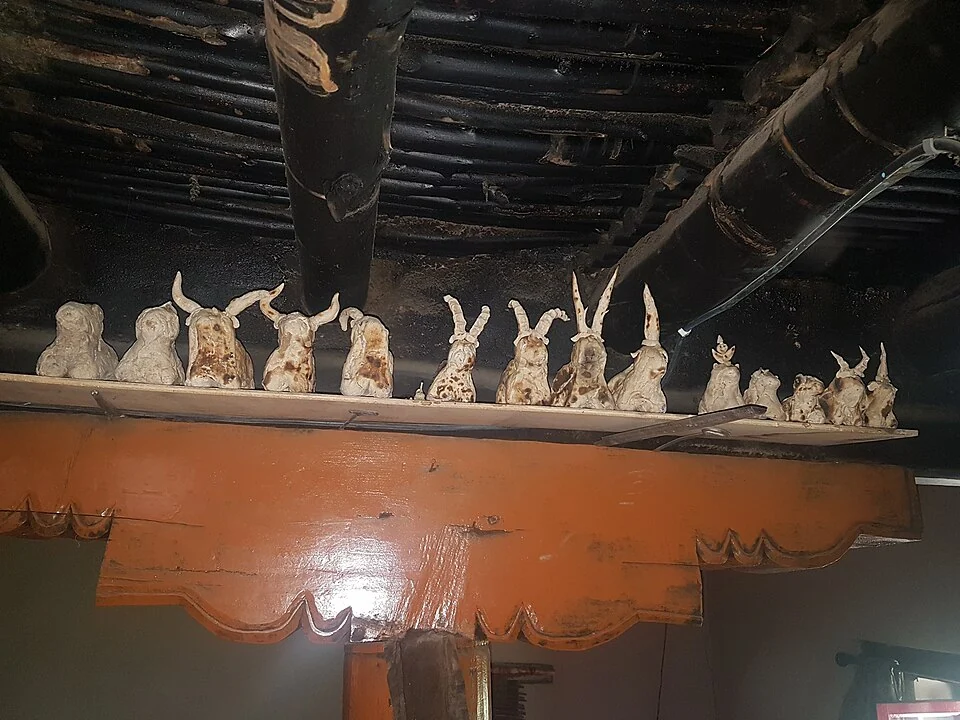
Losar is the New Year celebration observed in Ladakh's Tibetan Buddhist cultural setting. The name joins the Tibetan words for year and new. It belongs to a wider family of celebrations across the Himalayan region, but Ladakhi observance has its own timing and local practices. One community's calendar should not simply be substituted for another's.[1]
A Ladakhi New Year
The Ministry of Tourism's Ladakh account describes Losar as a celebration with cultural, spiritual and social significance. Household preparation and community observance make it more than one public stage event. Festival coverage should identify which village or organisation is being described rather than imply that every celebration is identical.[2]
The government heritage inventory for Nyoma places local Losar observance in the tenth month of the Tibetan lunar calendar and records community activities. This is useful evidence of regional variation: an account of Tibetan New Year elsewhere, often placed later in the Gregorian year, cannot establish the date for a Ladakhi village.[3]
Calendar and community
Lunar dates move relative to a fixed Gregorian date. A dependable visitor listing therefore needs a named year and confirmation from the local organiser. A photograph from a previous celebration can illustrate dress and gathering, but it is not an announcement that the same event will recur on the same day.
Public celebrations and household observance are related without being identical. A visitor may see a procession or performance while much of the festival's meaning remains in family meetings, preparation and religious practice. Explaining that difference gives a fuller account than describing only a colourful spectacle.
Read Hemis Festival for a distinct monastery-based celebration and Ladakhi Language for terminology and writing. Ice Hockey in Ladakh provides a separate winter-life subject. The Leh marker offers regional orientation; it does not identify a universal Losar venue, a household open to visitors or the boundary of all communities observing the festival.
Image and map record
Image: Peter Kason via Wikimedia Commons. Licence: CC BY-SA 4.0. Recorded capture date: 2018-07-15 13:42:40. Resized and converted to WebP; image content unchanged. This is a dated view, not confirmation of the site’s present appearance.

Map marker: 34.165, 77.585. Editorial regional-context marker. This biography, craft or cultural tradition is not a single physical destination. The point is not a verified birthplace, residence, workshop, exclusive origin, performance venue or cultural boundary. View location on OpenStreetMap · View Google Maps · Google directions · OpenStreetMap directions.
Research checked: 14 October 2026. For a visit, confirm current access, transport and opening information with the relevant authorities. This encyclopedia profile provides geographical and historical context.
Sources & references
[1] Reference overview: Losar
https://en.wikipedia.org/wiki/Losar ↗
[2] Ministry of Tourism: Ladakhi Losar
https://www.incredibleindia.gov.in/en/festivals-and-events/ladakh/losar ↗
[3] Ladakh heritage inventory: Nyoma
https://heritage.ladakh.gov.in/village/nyoma ↗
Image and licence
https://commons.wikimedia.org/wiki/File:Ladakh%27s_New_Year.jpg ↗
Related reading
Barley in Ladakh: Cultivation and Regional Food Traditions
Barley is a cereal grass cultivated for its grain. In Ladakh it forms part of the relationship between farming, household food and a limited mountain
Chang La: A High Pass on the Route towards Pangong
Chang La is a high mountain pass in Ladakh on the road corridor towards Durbuk, Tangtse and Pangong. It connects the Leh-side approaches through Karu
Gurdwara Pathar Sahib: Sikh Tradition in the Indus Valley
Gurdwara Pathar Sahib is a Sikh place of worship in the Indus-valley corridor west of Leh.