
Udhampur: Town and Regional Connections in Jammu
Udhampur is a town and district headquarters in the Jammu region. It functions as an administrative and transport centre within a hill landscape connected with Jammu and the road corridor towards Kashmir. The urban settlement, its district and nearby visitor destinations are different geographical units.
Udhampur is a town and district headquarters in the Jammu region. It functions as an administrative and transport centre within a hill landscape connected with Jammu and the road corridor towards Kashmir. The urban settlement, its district and nearby visitor destinations are different geographical units.[1]
Town and administration
The Udhampur administration identifies the town as the district headquarters. Its municipal history records an earlier town-area committee and the later municipal council. Those institutional changes describe local government rather than a sudden creation of the settlement itself.[2]
Official regional accounts associate Udhampur with the Devika and with surrounding hill destinations. A district's tourism list can include places outside the town, so an attraction listed on an Udhampur page should not automatically be described as a neighbourhood landmark.[3]
Transport and regional connections
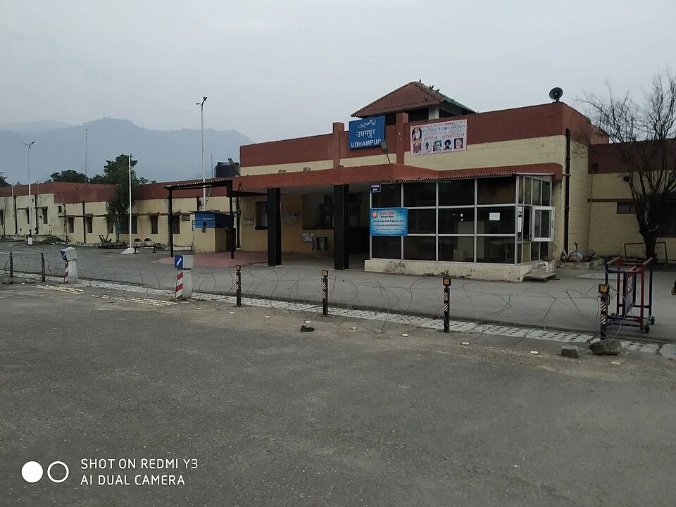
The railway station is one visible element in the town's connections. The supplied photograph identifies the station and its capture setting rather than claiming to show the entire urban area. A station's name, operating timetable and the wider rail corridor require separate records.
Road descriptions likewise need to distinguish a route from its current condition. A town can serve as a transit point without every service being available at every time. Current departures and journey arrangements belong to transport operators and dated official notices.
The Census of India's Udhampur handbook supplies a structured source for settlement and district information. It is most informative when the reference year and the town or rural unit are retained. Combining totals from different units would create a misleading picture of urban scale.[4]
Read Krimchi Temples, Ramnagar Palace and Jammu Tawi Railway Station for heritage and transport comparisons. The first two belong to distinct places in the wider regional setting, rather than one central-town complex. The marker identifies Udhampur town for orientation, not a railway entrance or the district boundary. Directions to a service should use that service's own verified location.
Image and map record
Image: Ashish itct via Wikimedia Commons. Licence: CC BY-SA 4.0. Recorded capture date: 2019-11-26 16:42:07. Resized and converted to WebP; image content unchanged. This is a dated view, not confirmation of the site’s present appearance.

Map marker: 32.915977, 75.141937. Source-recorded location for orientation; not a surveyed boundary, verified public entrance, current access guarantee or authorised stopping point. View location on OpenStreetMap · View Google Maps · Google directions · OpenStreetMap directions.
Research checked: 14 October 2026. For a visit, confirm current access, transport and opening information with the relevant authorities. This encyclopedia profile provides geographical and historical context.
Sources & references
[1] Reference overview: Udhampur
https://en.wikipedia.org/wiki/Udhampur ↗
[2] Udhampur administration: municipality history
https://udhampur.nic.in/municipality-udhampur/ ↗
[3] Udhampur administration: tourism and headquarters
https://udhampur.nic.in/tourism/ ↗
[4] Census of India: Udhampur district handbook, 2011
https://censusindia.gov.in/nada/index.php/catalog/526 ↗
Image and licence
https://commons.wikimedia.org/wiki/File:Udhampur_railway_station.jpg ↗
Related reading
Anantnag: Town, Springs and Southern Kashmir
Anantnag is a major town and district headquarters in southern Kashmir. The name also refers to the surrounding district, so town history and district
Aru: Village and Mountain Landscape above Pahalgam
Aru is a village and mountain visitor destination in Anantnag district, above the Pahalgam area. It is also known as Adav in Kashmiri. Meadows, settle
Basohli: Ravi-side Town and a Centre of Pahari Painting
Basohli is a town in Kathua district, in the Jammu region, overlooking the Ravi river landscape.