
Lolab Valley: Villages, Forests and the Lalkul Waterscape
Lolab’s stream, villages, cultivated ground and forested slopes within Kupwara district.
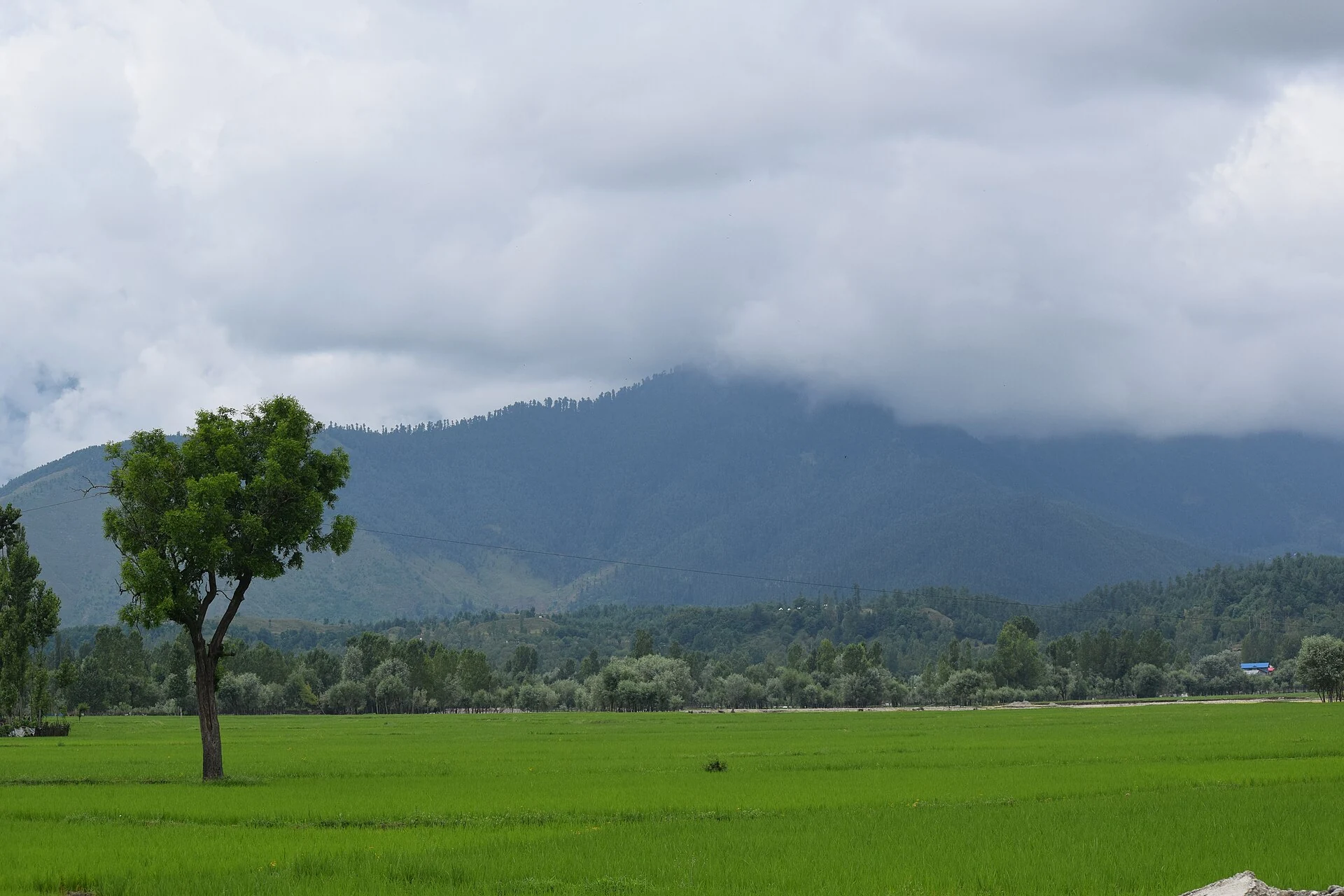
Lolab is a valley and group of settlements in Kupwara district, in northern Kashmir. Its identity comes from the combination of villages, cultivated ground, wooded slopes and the Lalkul stream. Calling it a valley rather than a single resort is important: Lolab includes several inhabited places whose histories and daily life cannot be reduced to one viewpoint. The district’s account names Chandigam, Khurhama, Krusan and other localities within this wider landscape.[1]
The valley and its watercourse
The Kupwara administration describes a long valley, varying considerably in width, traversed by the Lalkul or Lahwal stream. Tributaries reach it from the surrounding hills. This arrangement gives the landscape a recognisable relationship between higher slopes and the settled valley floor. Forest, pasture and cultivation occupy different parts of that setting, rather than forming one continuous area of undisturbed woodland.[1]
The secondary geographical description characterises Lolab as a sub-valley of the larger Kashmir Valley. It identifies rural settlements and fruit-growing associations alongside forested hills. A map point near the valley’s centre can orient a reader, but it does not define the valley’s full extent or locate every village. The same is true of a landscape photograph: it may show the relationships between fields and slopes without representing all of Lolab.[2]
Named places and local history
The district profile records Lov-nag in Anderbaugh and the Sat Barran site near Kalaroos. It also identifies Varnow as the birthplace of scholar Anwar Shah Kashmiri. These references add springs, structures and intellectual biography to the valley’s geographical description. Stories about remote connections through caves should remain recognised as local traditions unless independent archaeological evidence establishes a particular passage or destination.[1]
Kupwara’s district history records its creation from the earlier Baramulla district in 1979 and identifies Lolab among its notable valleys. This gives the article an administrative frame while retaining the distinction between the valley and the district. The valley’s landscape did not begin with that administrative change; a boundary history and the history of individual settlements are different kinds of chronology.[3]
A rural landscape rather than a backdrop
Fields, houses, roads and wooded ground are all parts of Lolab’s character. The secondary profile’s agricultural description is especially useful because it keeps livelihood within the picture. A place may be valued for its scenery while also being land where people cultivate, graze animals and move between villages. These activities should not disappear from an encyclopedia account simply because visitor descriptions favour mountains and forests.[2]
The district identifies Kupwara town as the main approach to Lolab. That is a regional connection, not a fixed journey time to every locality. Choosing a particular village or site matters more than treating “Lolab” as one address. Current road arrangements should be checked for the actual destination, especially when moving beyond the principal settled corridor.
Compare Pahalgam and Bhaderwah for other relationships between towns and surrounding valleys. Kashmir saffron introduces a different agricultural landscape, while Wular Lake follows water and livelihood in another part of northern Kashmir.
Photograph and map record
Photograph: Eshankaul007 via Wikimedia Commons. Licence: CC BY-SA 4.0. Recorded capture date: 2015-07-10 12:11:39. Resized and converted to WebP; scene content unchanged. This is a dated view, not confirmation of the site’s present appearance.

Map marker: 34.49722222, 74.4125. Representative coordinate from the secondary geographical reference; not a surveyed boundary or a verified accessible entrance. View location on OpenStreetMap · View Google Maps · Google directions · OpenStreetMap directions.
Research checked: 14 October 2026. For a visit, confirm current access, transport and opening information with the relevant authorities. This encyclopedia profile provides geographical and historical context.
Sources & references
[1] Primary place or institutional account
https://kupwara.nic.in/tourist-place/lolab/ ↗
[2] Secondary historical and geographical reference
https://en.wikipedia.org/wiki/Lolab_Valley ↗
[3] District Kupwara — District formation and geography
https://kupwara.nic.in/about-district/ ↗
Photograph and licence
https://commons.wikimedia.org/wiki/File:Lolab_Valley-Kupwara.JPG ↗
Related reading
Doodhpathri: Meadow, Streams and the Budgam Uplands
Doodhpathri is a meadow destination in Budgam district's Khansahib area, in the Pir Panjal uplands.
Tulail Valley: Settlements and the Kishanganga Mountain Landscape
Tulail is a mountain valley in Bandipora district, connected with the wider Gurez and Kishanganga landscape.
Yusmarg: Meadows, Forests and a Budgam Mountain Landscape
Yusmarg, also written Yousmarg, is a meadow and mountain destination in Budgam district.