
Budgam: Town and District Headquarters in Kashmir
Budgam, known as Badgom in Kashmiri, is a town and district headquarters in central Kashmir. Its name is also used for a district containing many other towns, villages and mountain landscapes. A profile of the headquarters should therefore remain distinct from a catalogue of every attraction in the district.
Budgam, known as Badgom in Kashmiri, is a town and district headquarters in central Kashmir. Its name is also used for a district containing many other towns, villages and mountain landscapes. A profile of the headquarters should therefore remain distinct from a catalogue of every attraction in the district.[1]
Town and district history
The Budgam administration identifies the present town as the district headquarters and records earlier names in its historical account. Such naming traditions contribute to local history, while an exact founding date would require additional evidence. A remembered place-name explanation is not automatically a dated event.[2]
The district was formed through administrative reorganisation in 1979. That date concerns the district arrangement, not the first existence of Budgam as a settlement. Institutional change and settlement history should not be collapsed into a single beginning.[3]
Institutions and surrounding places
As a headquarters, the town is associated with administrative activity and public institutions. Their individual addresses matter for a user searching for a school, office or service. A town-centre marker cannot stand in for every institution's entrance.
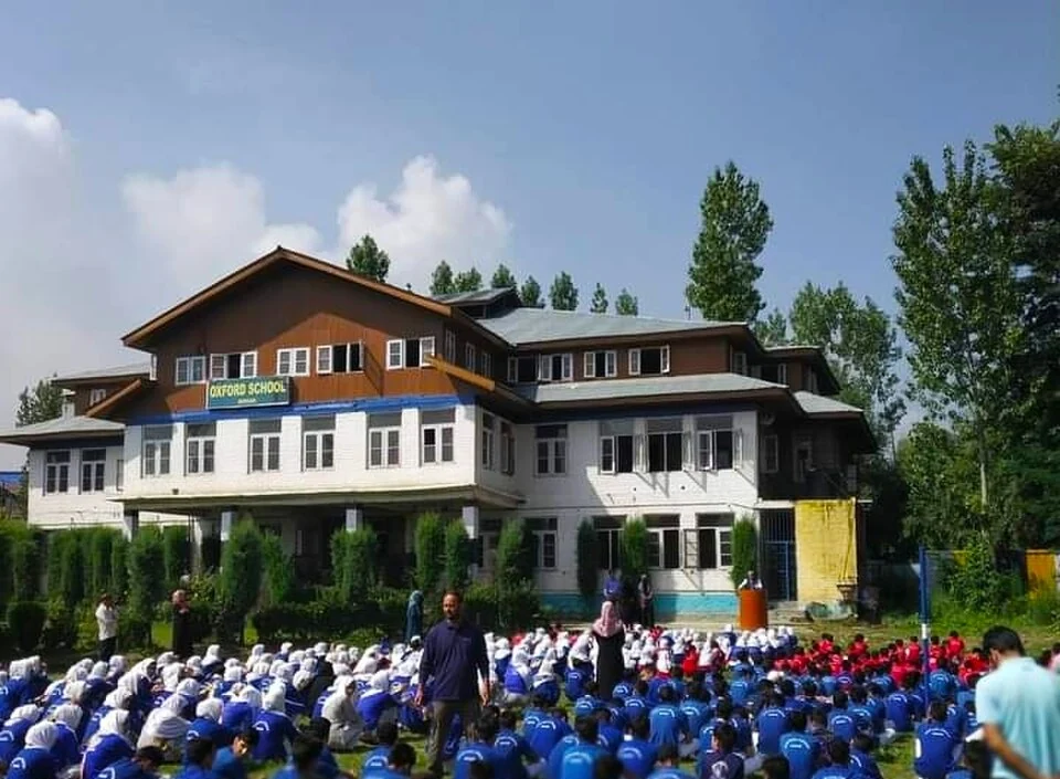
The supplied photograph is source-identified as a morning assembly at Oxford School of Education in Budgam. It illustrates one named educational setting, not a panorama of the whole town or a current advertisement for admission. The institution and the district landscape remain separate subjects.
Budgam's wider geography includes cultivated ground, settlements and upland destinations. A district tourism description may highlight places at considerable distance from the headquarters. Keeping town and district scales visible makes nearby-place search more reliable.
Read Charar-e-Sharief, Yusmarg and Doodhpathri for distinct places in the wider district. Bhand Pather adds a regional cultural subject whose performers are not confined to the headquarters. The marker identifies Budgam town for orientation, not the district boundary, school gate or a railway-station entrance. A specific journey should use a verified destination point rather than this general context marker.
Image and map record
Image: Hulged via Wikimedia Commons. Licence: CC BY-SA 4.0. Recorded capture date: 2021-01-22. Resized and converted to WebP; image content unchanged. This is a dated view, not confirmation of the site’s present appearance.

Map marker: 34.015, 74.722. Source-recorded location for orientation; not a surveyed boundary, verified public entrance, current access guarantee or authorised stopping point. View location on OpenStreetMap · View Google Maps · Google directions · OpenStreetMap directions.
Research checked: 14 October 2026. For a visit, confirm current access, transport and opening information with the relevant authorities. This encyclopedia profile provides geographical and historical context.
Sources & references
[1] Reference overview: Budgam
https://en.wikipedia.org/wiki/Budgam ↗
[2] Budgam administration: town history
https://budgam.nic.in/history/ ↗
[3] Budgam administration: district reorganisation
https://budgam.nic.in/about-district/ ↗
Image and licence
https://commons.wikimedia.org/wiki/File:Oxford_school_budgam.jpg ↗
Related reading
Anantnag: Town, Springs and Southern Kashmir
Anantnag is a major town and district headquarters in southern Kashmir. The name also refers to the surrounding district, so town history and district
Aru: Village and Mountain Landscape above Pahalgam
Aru is a village and mountain visitor destination in Anantnag district, above the Pahalgam area. It is also known as Adav in Kashmiri. Meadows, settle
Basohli: Ravi-side Town and a Centre of Pahari Painting
Basohli is a town in Kathua district, in the Jammu region, overlooking the Ravi river landscape.